943
WWUS83 KIND 170456
SPSIND
Special Weather Statement
National Weather Service Indianapolis IN
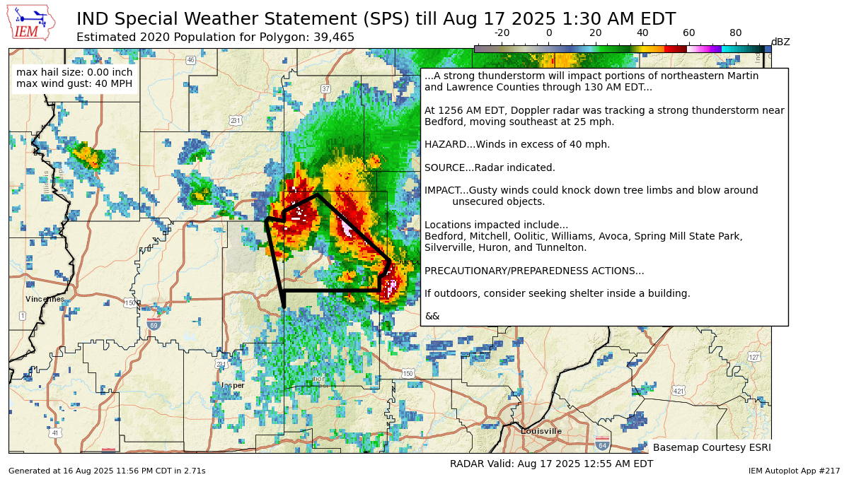
1256 AM EDT Sun Aug 17 2025
INZ069-070-170530-
Martin IN-Lawrence IN-
1256 AM EDT Sun Aug 17 2025
...A strong thunderstorm will impact portions of northeastern Martin
and Lawrence Counties through 130 AM EDT...
At 1256 AM EDT, Doppler radar was tracking a strong thunderstorm near
Bedford, moving southeast at 25 mph.
HAZARD...Winds in excess of 40 mph.
SOURCE...Radar indicated.
IMPACT...Gusty winds could knock down tree limbs and blow around
unsecured objects.
Locations impacted include...
Bedford, Mitchell, Oolitic, Williams, Avoca, Spring Mill State Park,
Silverville, Huron, and Tunnelton.
PRECAUTIONARY/PREPAREDNESS ACTIONS...
If outdoors, consider seeking shelter inside a building.
&&
LAT...LON 3890 8675 3891 8674 3890 8668 3893 8668
3898 8655 3878 8627 3874 8629 3873 8631
3869 8631 3869 8668 3864 8668
TIME...MOT...LOC 0456Z 333DEG 22KT 3888 8661
MAX HAIL SIZE...0.00 IN
MAX WIND GUST...40 MPH
$$
GM
https://mesonet.agron.iastate.edu/p.php?pid=202508170456-KIND-WWUS83-SPSIND
Warnings always on My Huge Radar!
Never miss me! Subscribe for free. My Huge Radar has real-time weather tracking, current temperatures, and severe weather watches and warnings. Get detailed Indiana conditions by clicking here. Click here to see my central Indiana 7-Day Forecast. Follow these links to get my forecasts for Lafayette, Muncie, Hendricks County, and Hamilton County. Need a second opinion? Click here for central Indiana National Weather Service forecasts. (Some charts via WeatherBELL.)


