HEADLINES
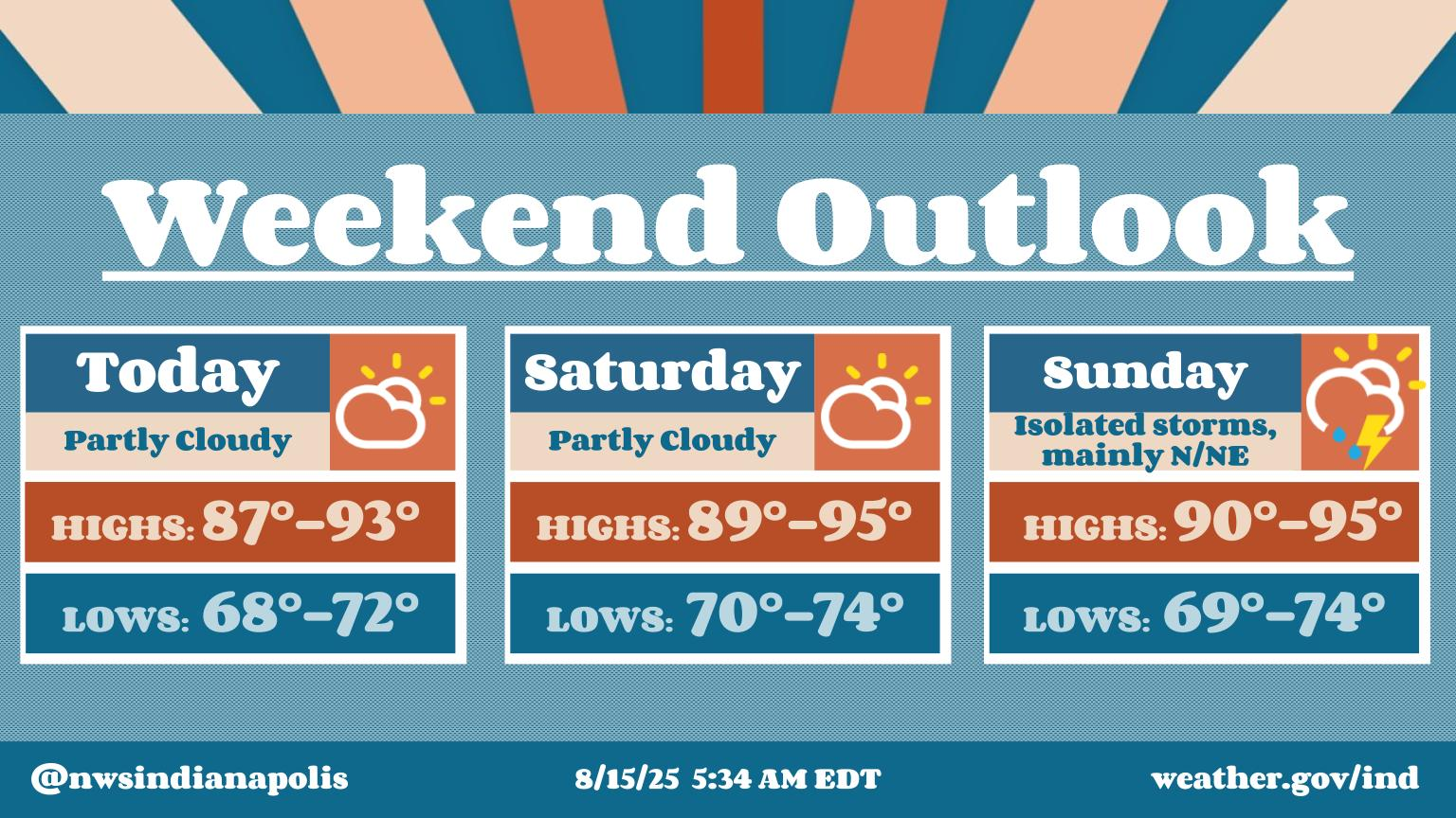
– Heat increases today, humidity tomorrow into the weekend until Tuesday.
– Heat index values near or exceeding 100 at times likely Saturday through Tuesday.
– Isolated storm possible in the weekend afternoons and Monday.
– Greater threat for storms Tuesday and Wednesday ahead of a (welcome!) cold front.
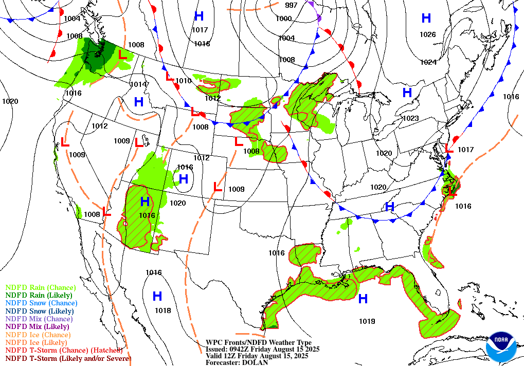
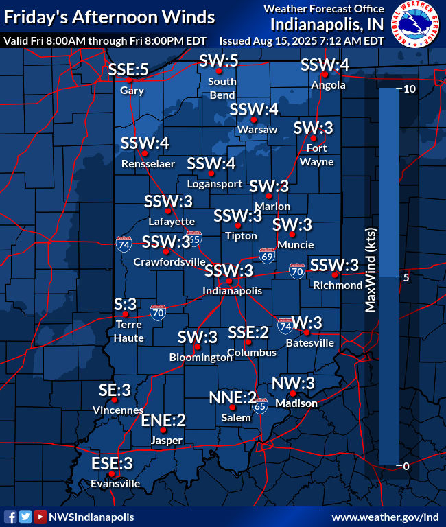
TODAY’S MAP
NWS TECHNICAL DISCUSSION
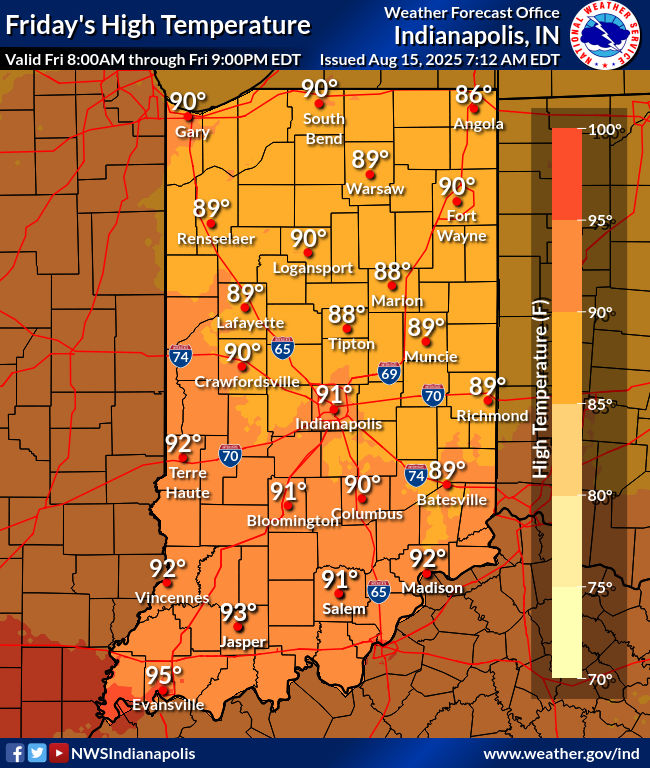
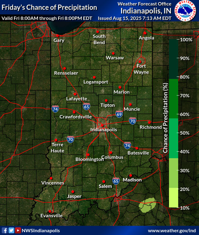
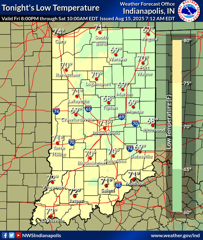
Scattered cumulus will pop up during the day, but warming mid-level
temperatures should prevent these from growing into showers and
storms. However, cannot absolutely rule out a stray shower. Odds for
these will be less than 15 percent, so will not mention.

Highs will be around 90 today, but it will feel more like the lower
and middle 90s thanks to the higher dewpoints.

Tonight...

Cumulus will dissipate this evening, but some high clouds from
convection well to the northwest may move into the area during the
night. With the higher dewpoints and light winds expected, patchy
ground fog will develop in favored areas.

A few CAMs are showing convection riding around the upper high into
the area late tonight. However, these develop storms farther south
than would be expected given location of forcing. Will side with the
majority of CAMs and keep the area dry.

Lows will be in the upper 60s and lower 70s.

&&

.LONG TERM (Saturday through Thursday)...
Issued at 301 AM EDT Fri Aug 15 2025

Saturday through Monday...

The main focus early in the extended will be unseasonably hot and
humid conditions. Aloft, ridging remains near the region keeping an
anomalously hot airmass in place. Highs in the low-mid 90s combined
with high humidity will lead to peak heat indices reaching near 100-
105 degrees each afternoon. Increasing low-level moisture may be
enough to promote a few diurnal showers Saturday given strong
daytime heating, but potential appears too low to add any rain
chances at this time.

Guidance suggest there is another slightly higher chance for
precipitation Sunday or Monday when upstream storm complexes riding
along the ridge propagate towards the area. These storms should
weaken as they move into a less favorable environment over Indiana
with weaker forcing and deep-layer shear. However, cannot rule out
convection persisting into portions of central Indiana. Will keep
low POPs primarily over northern counties on Sunday to account for
the low potential. POPs were not added for Monday due to diverging
model solutions limiting forecast confidence.

It is typical for models to struggle with these subtle impulses
riding along the northern periphery of ridges. Rain chances will
likely need to be refined once guidance becomes better aligned. Any
convection or convective cloud debris could limit peak heat indices.

Tuesday onward...

Upper troughing setting up over the region Tuesday and Wednesday
along with a cold front moving through will support better chances
for precipitation. Uncertainty in exact details remains due to
diverging model solutions though. Expect greater coverage of showers
or thunderstorms with the threat for localized heavy rain and gusty
winds. Peak heat indices around 100-105 are still possible Tuesday
ahead of the cold front before cooler air filters in mid-late week.
Highs should generally fall into the 80s again towards late next
week with lower humidity. Rain chances will also diminish as a drier
airmass moves in.
INDY SEVEN DAY FORECAST
Today: Mostly sunny. Hotter. High 91.
Tonight: Mostly clear. Humidity increases. Low 72.
Saturday: Mostly sunny. Hot and humid. Isolated late afternoon shower or storm possible. High 93.
Saturday Night: Partly cloudy. Isolated shower or storm possible. Low 74.
Sunday: Mostly sunny. Isolated late afternoon shower or storm possible. High 95.
Sunday Night: Partly cloudy. Low 74.
Monday: Partly sunny, with spotty afternoon showers and storms. High 95.
Monday Night: Partly cloudy. Low 74.
Tuesday: Partly to mostly cloudy, with scattered showers and storms. High 92.
Tuesday Night: Scattered showers and storms. Low 72.
Wednesday: Partly to mostly cloudy, with scattered showers and storms mainly in the morning. High 84.
Wednesday Night: Partly cloudy. Not as humid! Low 66.
Thursday: Partly sunny. High 83.

Never miss me! Subscribe for free. My Huge Radar has real-time weather tracking, current temperatures, and severe weather watches and warnings. Get detailed Indiana conditions by clicking here. Click here to see my central Indiana 7-Day Forecast. Follow these links to get my forecasts for Lafayette, Muncie, Hendricks County, and Hamilton County. Need a second opinion? Click here for central Indiana National Weather Service forecasts. (Some charts via WeatherBELL.)


