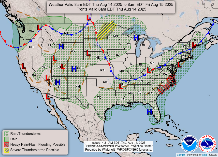
…Locally heavy rain and flash flooding possible near the
Mid-Atlantic/Carolina coast today followed by more scattered thunderstorms
on Friday and into the weekend…
…Rounds of strong to severe thunderstorms expected to impact portions of
the Northern Plains to the upper Midwest through the next couple of days…
…A couple of days of heat across the central High Plains as major to
locally extreme HeatRisk is forecast for northern to central Florida…
Under a stagnant weather pattern, warm and moist air already in place
across much of the eastern U.S. into the Deep South will continue to
promote the developments of scattered showers and thunderstorms within
this area ahead of a weak upper trough. The thunderstorms are expected to
be more numerous from late afternoon into the evening hours through the
next couple of days. Locally heavy rain and flash flooding will be
possible today into tonight near the Mid-Atlantic/Carolina coast where a
trough of low pressure lingers while a cold front nudges toward the area
from interior Mid-Atlantic. A Slight Risk (Level 2/4) of Excessive
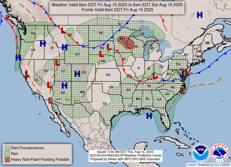
Rainfall is highlighted for the area near the coast. By Friday, the
southward progression of the front should usher in a more stable airmass,
in turn decreasing thunderstorm coverage across the Tennessee Valley.
Nevertheless, isolated instances of flash flooding remain possible ahead
of the front extending from the lower Mississippi Valley into the
Northeast.
Meanwhile, a deepening low pressure system over the Canadian prairies will
drive a warm front across the Northern Plains. Rounds of strong to severe
thunderstorms are expected to be triggered and then impact portions of the
Northern Plains to the upper Midwest through the next couple of days. The
primary hazards associated with these thunderstorms are damaging wind
gusts and isolated large hail. As the warm front advances eastward and
then collides with a cold front pushing in from the Canadian prairies, the
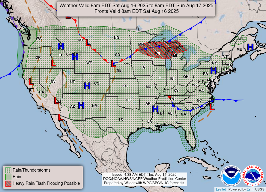
severe weather threat will then head further east across the upper Midwest
on Friday, reaching into the upper Great Lakes by Saturday morning.
Cooler temperatures behind the cold front will allow for temperatures to
gradually trend below normal across the northern High Plains and
especially the Northwest U.S. for the latter part of the week. This will
bring a break from the hot weather that portions of the Intermountain West
have been experiencing. Over the next couple of days, the core of the
heat will shift focus into the central Plains, where high temperatures
reaching the century mark can be expected. Across northern Florida, a
slight increase of heat and humidity is enough to raise HeatRisk into
Major and locally Extreme levels through the next couple of days as the
Bermuda High builds westward into the Sunshine State. Meanwhile,
monsoonal moisture will linger across the southern Rockies where scattered
thunderstorms are expected to spread gradually northward into the Four
Corners by the weekend.
Kong/Asherman
Graphics available at
https://www.wpc.ncep.noaa.gov/basicwx/basicwx_ndfd.php