HEADLINES
– Temps above average for at least the next week.
– Humidity is also back, and will go up a notch tomorrow.
– Next shower and storm chances: Tuesday.
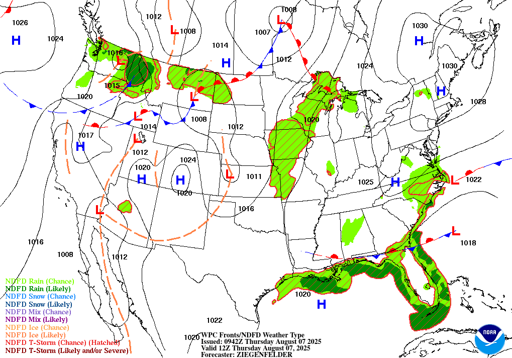
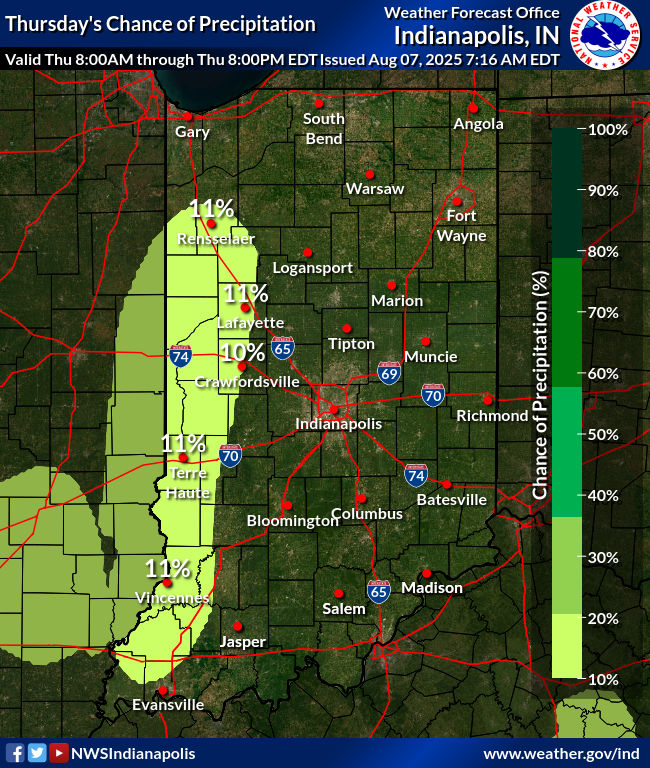
TODAY’S MAP
NWS TECHNICAL DISCUSSION
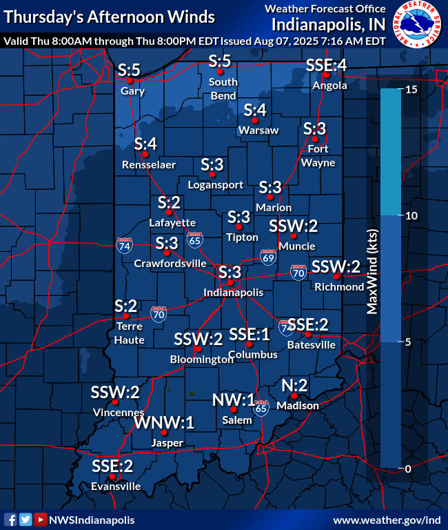
Surface high pressure remains to our east with a light east to east-
southeasterly flow present at times. For the most part, surface MSLP
gradients are too weak to promote any kind of wind. Most
observations as of 2am are showing calm conditions. Combined with
mostly clear skies above, radiational cooling has been efficient
with fog already being reported in spots. Continued expansion of fog
appears likely given ideal conditions. Some locally dense fog is
possible by morning. However, a weak vort max has allowed for some
clouds across our west and northwest, which may limit further fog
development in these areas. Cloud cover should gradually spread
eastward for the remainder of the night. Gradual clearing is likely
after sunrise as the vort max weakens.

High pressure should gradually shift southward along the eastern
seaboard today, allowing our weak surface flow to become more
southerly. Ridge-building aloft over the Great Lakes will support a
generally subsident atmosphere over Indiana. With increasing
heights, we`ll likely see a warmer day today compared to previous
days. Readings in the upper 80s to near 90 will be common.
Additionally, increasing humidity will make it feel more oppressive
than it has.

Precip chances look low, but non-zero. While subsidence and dry mid-
level air should largely prevent convective development, there may
be enough instability for an isolated shower somewhere within our
CWA. Chances of this at any one location are quite low, less than 10
percent. Will leave mentionable PoPs out of the forecast for now
given how isolated potential shower activity appears to be.

Guidance shows greater convective chances over northern Illinois
late in the day today. There`s a low chance that this activity,
should it develop, propagates southward into northern parts of our
area overnight into Friday. Some factors that favor this include a
15-25kt southwesterly low-level jet impinging into NW Indiana after
about 03z. This jet weakens considerably south of the Lafayette
area. Additionally, about 20kt of northwesterly shear are indicated
in RAP forecast soundings. This may be sufficient for cold pool
shear balance, which would allow any upstream convective system to
propagate southward during the night. Any southward-moving MCS would
likely weaken quickly as effects of the LLJ diminish.

All of the above is contingent on upstream convection forming a cold
pool. Should this occur, then the probability of southward
propagation into our CWA increases dramatically. Guidance is hinting
at this but is notoriously bad with depicting cold pool formation
and subsequent evolution. Convective trends upstream will need to be
monitored closely tonight into Friday. Regardless, severe weather
does not appear likely given weak shear and the likelihood for any
approaching system to quickly become outflow dominant.

&&

.LONG TERM (Friday through Wednesday)...
Issued at 306 AM EDT Thu Aug 7 2025

A return to hot and humid conditions appears likely early in the
long term. Ensemble guidance is in good agreement showing ridge-
building over the Great Lakes through the weekend. Some forecast
uncertainty exists on Friday, however, due to upstream convective
potential (see short term section for details). There`s a low
probability of a convective complex forming upstream and propagating
south into central Indiana by Friday morning. Should this occur,
then temperatures would likely be a bit lower than current guidance
given rain-cooled air and lingering cloud cover.

A trough looks to approach early next week along with an attendant
cold front. Unfortunately this also means showers and thunderstorms
chances may persist well into the new week. Some members of guidance
take a while to bring the front through...with it potentially
lingering nearby into Wednesday. Flow aloft is weak and so we`re not
expecting any organized severe threat. Our primary storm hazard may
once again be heavy rain and localized flooding.

Given uncertainty regarding the timing of the cold front, we will
maintain chance PoPs through Wednesday. Temperatures will depend on
the timing and strength of the front as well. A slower and weaker
front will allow hot/humid weather to persist while the opposite is
true of a stronger/faster front.
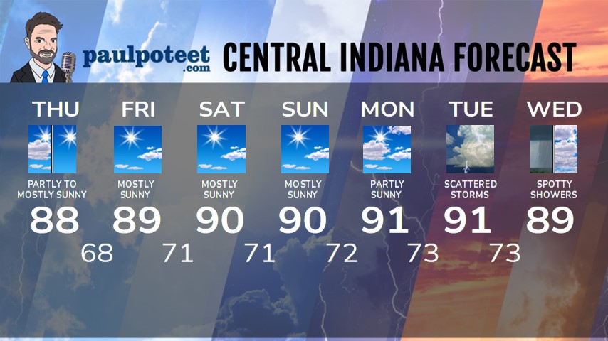
INDY SEVEN DAY FORECAST
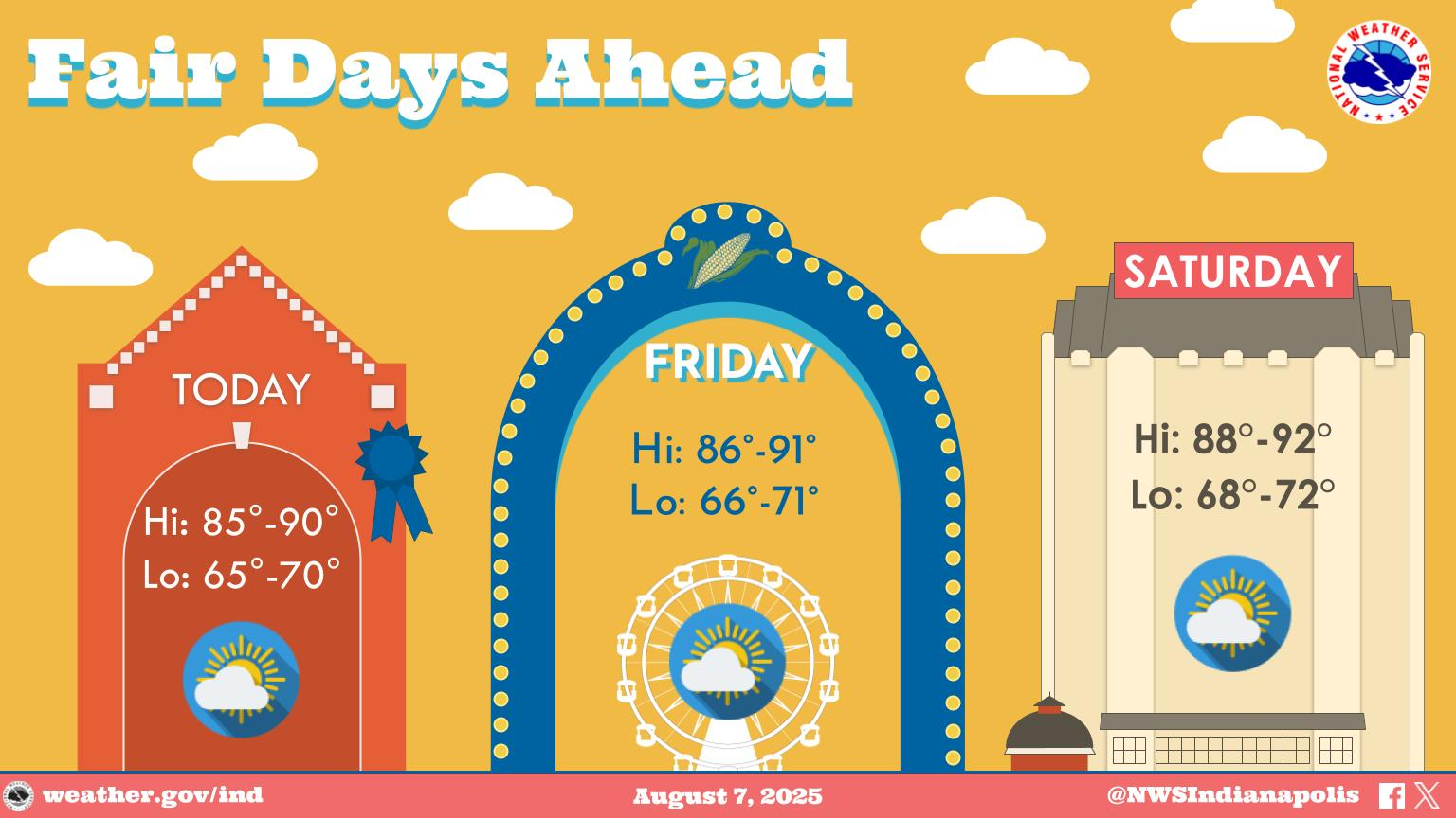
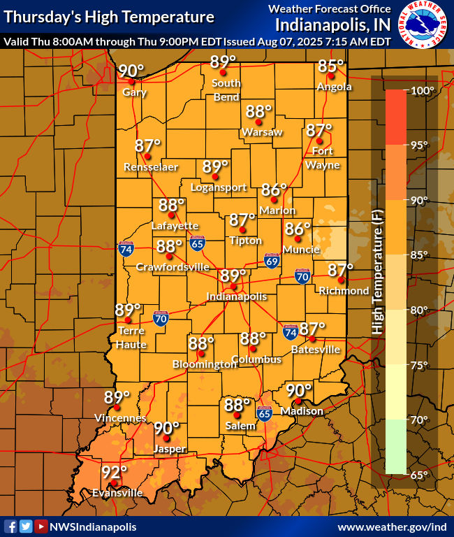
Today: Partly to mostly sunny. High 88.
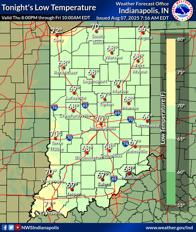
Tonight: Mostly clear. Low 68.
Friday: Mostly sunny, hot and humid. High 89.
Friday Night: Mostly clear. Low 71.
Saturday: Mostly sunny. High 90.
Saturday Night: Mostly clear. Low 71.
Sunday: Mostly sunny. High 90.
Sunday Night: Mostly clear. Low 72.
Monday: Partly sunny. High 91.
Monday Night: Partly cloudy. Low 73.
Tuesday: Partly to mostly cloudy, with scattered showers and storms. High 91.
Tuesday Night: Scattered showers and storms. Low 73.
Never miss me! Subscribe for free. My Huge Radar has real-time weather tracking, current temperatures, and severe weather watches and warnings. Get detailed Indiana conditions by clicking here. Click here to see my central Indiana 7-Day Forecast. Follow these links to get my forecasts for Lafayette, Muncie, Hendricks County, and Hamilton County. Need a second opinion? Click here for central Indiana National Weather Service forecasts. (Some charts via WeatherBELL.)


