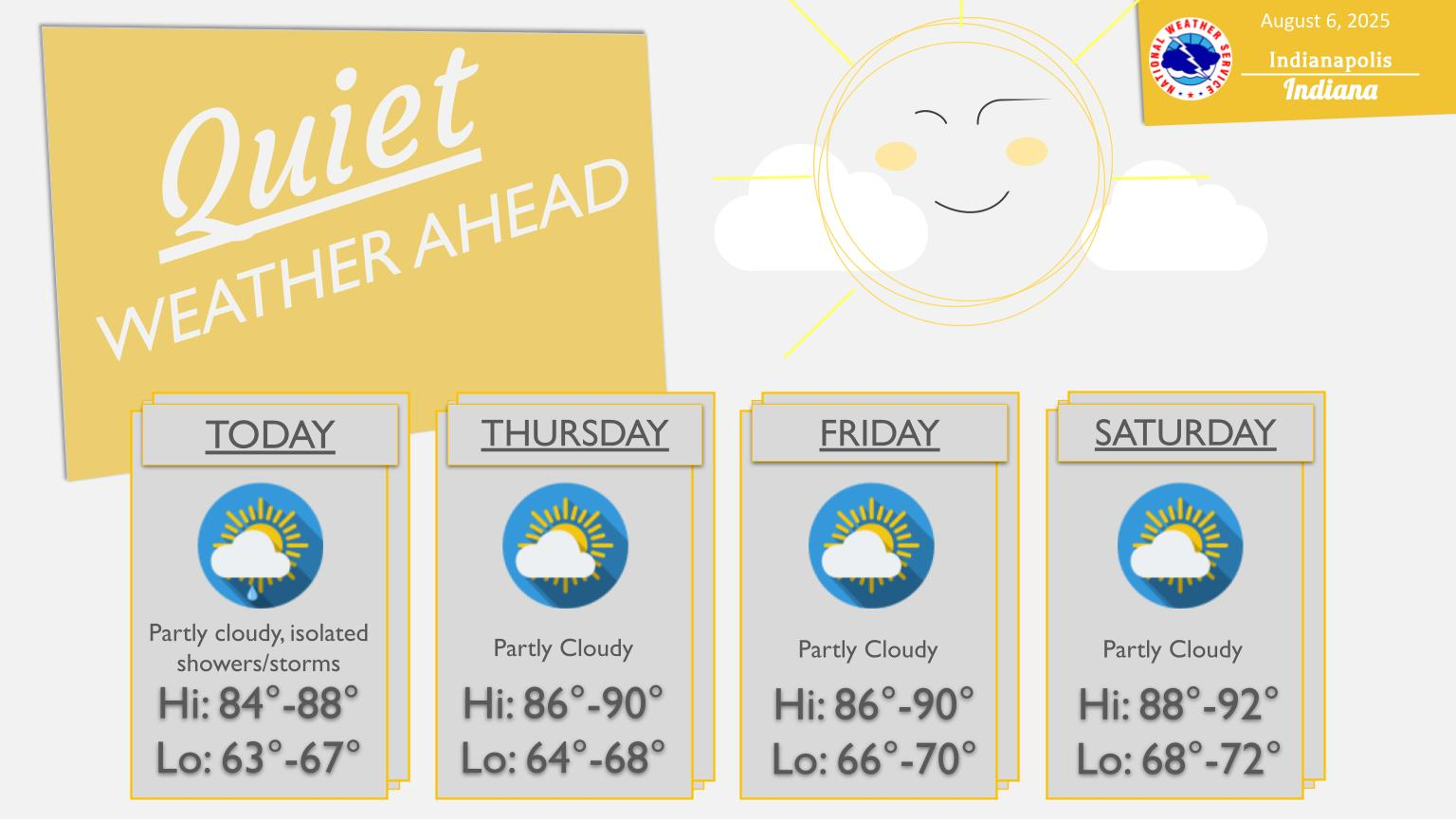
HEADLINES
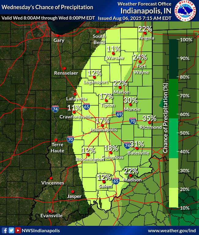
– Isolated shower or storm is possible in the eastern third of the state this afternoon.
– Average high temp today. It will be above average and humid Friday through the weekend.
– Next general rain and storm chance is Tuesday.
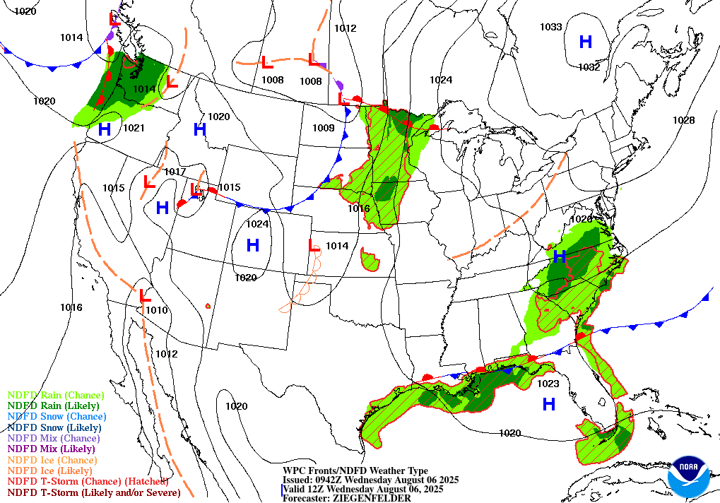
TODAY’S MAP
NWS TECHNICAL DISCUSSION
After sunrise, any lingering fog should dissipate. Cumulus growth is
expected by late morning as the boundary layer deepens and
temperatures quickly climb into the 80s. Aloft, guidance shows a
weak trough axis passing east of Indiana today which will leave us
within a subsident atmosphere. Subsidence is weak, however, and
there may be enough instability present to overcome it. Any shower
or thunderstorm that develops will be isolated and weak. Another
mitigating factor is dry mid-level air. Any aspiring updraft will
need to survive dry air entrainment in order to grow into an actual
thunderstorm. Shear is essentially non-existent, so any storm that
makes it will be pulse-like in nature and short-lived. Locally
heavy rainfall is possible in the strongest storms. Best chance
of precip is across our eastern counties where subsidence is a bit
less.

Tonight looks to be similar to previous nights with clearing skies
and patchy fog. Guidance shows a slightly drier boundary layer and
so fog may be more limited than the previous night. Typically fog-
prone locations stand to see the highest chance of patchy fog.

&&

.LONG TERM (Thursday through Tuesday)...
Issued at 254 AM EDT Wed Aug 6 2025

A return to hot and humid conditions appears likely early in the
long term. Ensemble guidance is in good agreement showing ridge-
building over the Plains spreading eastward by the weekend. At the
surface, high pressure nearby should allow for a generally subsident
atmosphere which will limit cloud cover and storm chances.

Thankfully, the flow pattern aloft appears rather progressive,
albeit slow, so the heat and humidity does not appear to stick
around long. A trough approaches late in the weekend along with an
attendant cold front. Unfortunately this also means showers and
thunderstorms which may persist into the new week. Some members of
guidance take a while to bring the front through...with it
potentially lingering nearby into Wednesday. Flow aloft is weak and
so we`re not expecting any organized severe threat. Our primary
storm hazard may once again be heavy rain and localized flooding.

Given uncertainty regarding the timing of the cold front, we will
maintain chance PoPs through Wednesday. Temperatures will depend on
the timing and strength of the front as well. A slower and weaker
front will allow hot/humid weather to persist while the opposite is
true of a stronger/faster front.
INDY SEVEN DAY FORECAST
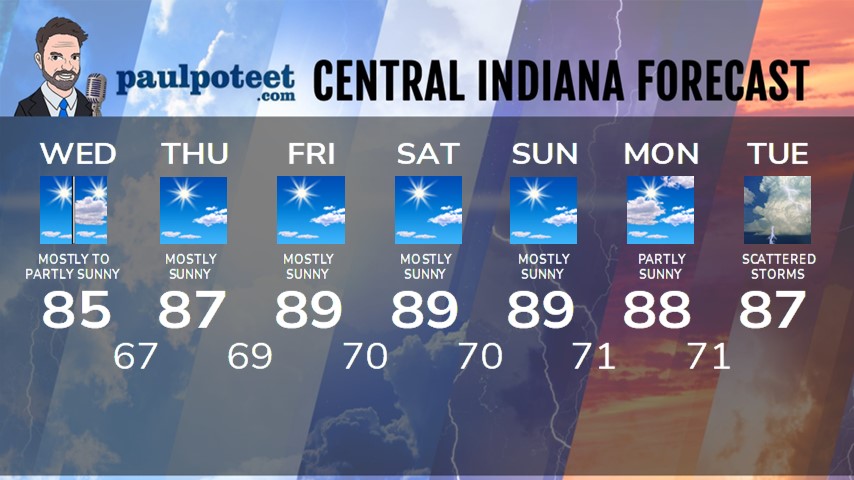
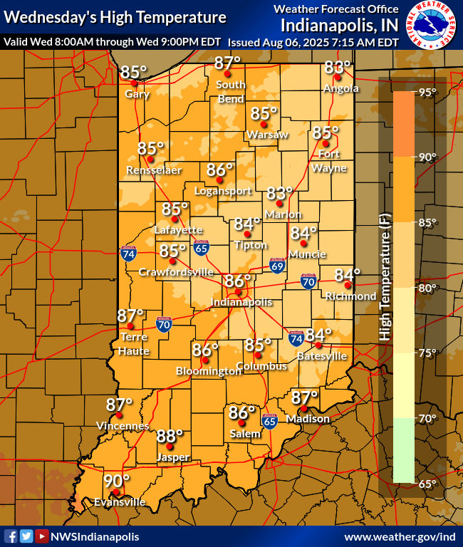
Today: Patchy morning fog, then mostly to partly sunny. High 85.
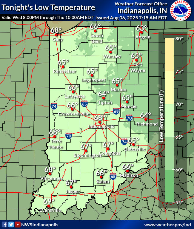
Tonight: Mostly clear. Low 67.
Thursday: Mostly sunny. High 87.
Thursday Night: Mostly clear. Low 69.
Friday: Mostly sunny, hot and humid. High 89.
Friday Night: Mostly clear. Low 70.
Saturday: Mostly sunny. High 89.
Saturday Night: Mostly clear. Low 70.
Sunday: Mostly sunny. High 89.
Sunday Night: Mostly clear. Low 71.
Monday: Partly sunny. High 88.
Monday Night: Partly cloudy. Low 71.
Tuesday: Partly to mostly cloudy, with scattered showers and storms. High 87.
Never miss me! Subscribe for free. My Huge Radar has real-time weather tracking, current temperatures, and severe weather watches and warnings. Get detailed Indiana conditions by clicking here. Click here to see my central Indiana 7-Day Forecast. Follow these links to get my forecasts for Lafayette, Muncie, Hendricks County, and Hamilton County. Need a second opinion? Click here for central Indiana National Weather Service forecasts. (Some charts via WeatherBELL.)


