HEADLINES
– Patchy dense fog early.
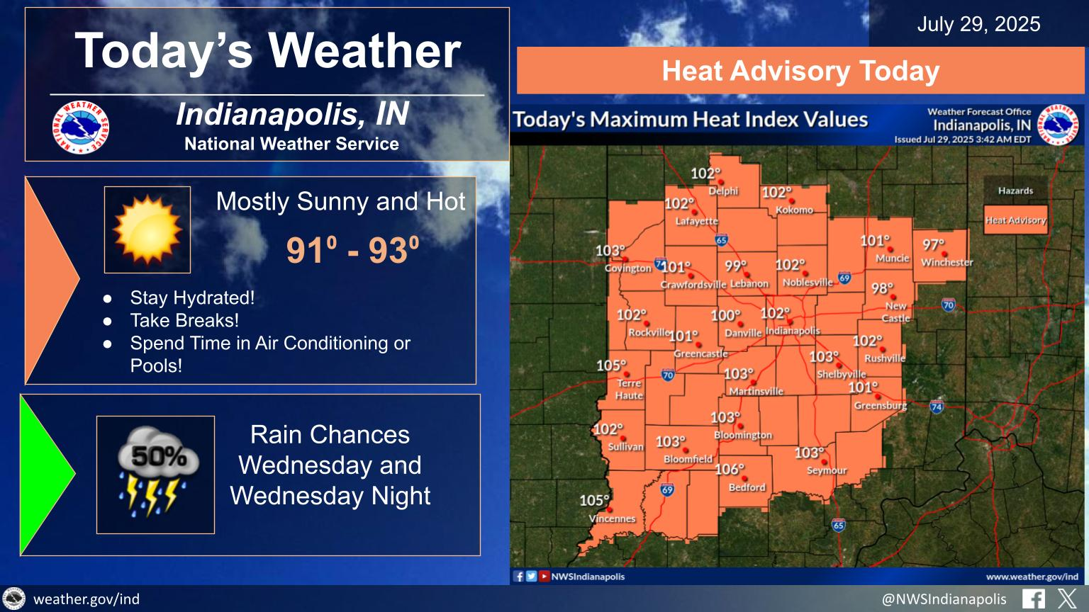
– Heat Advisory in effect through 8PM.
– Storms Wednesday Night and Thursday with the potential for localized flooding.
– Cooler temperatures and dry weather in store for end of week into the weekend.
TODAY’S MAP
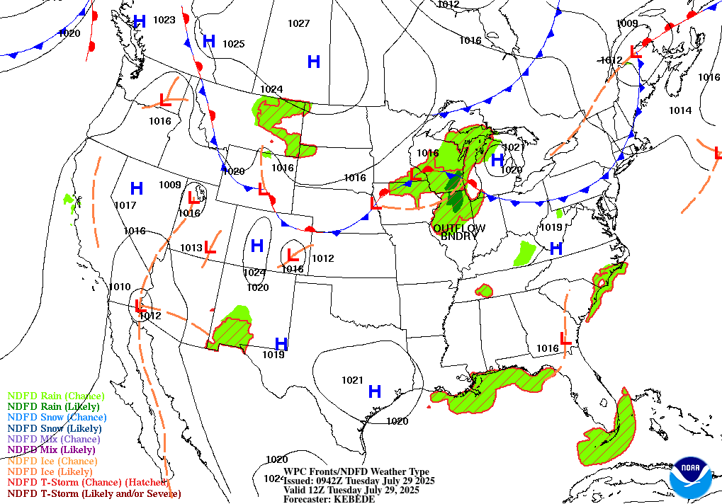
NWS TECHNICAL DISCUSSION
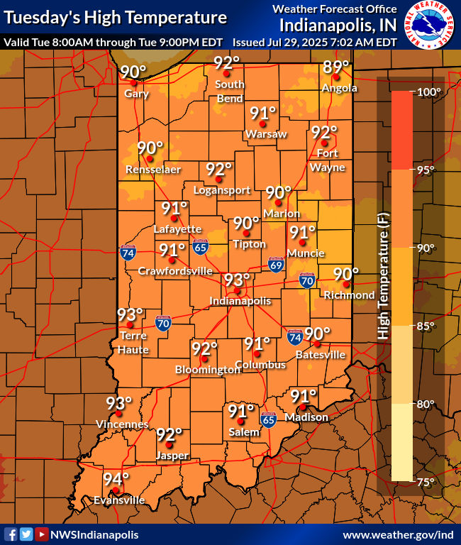
As of early this morning, fog coverage has been gradually increasing
over the last couple of hours with coverage highest so far across
the southern counties which saw periods of heavy rain yesterday. Hi-
resolution models also key on other favored fog formation zones such
as river valleys. Any fog will quickly burn off after daybreak with
yet another hot and humid day in store across central Indiana as the
ridge across the Ohio Valley persists. Precipitation chances will be
minimal today with drier air aloft limiting the instability. This
drier air aloft will also allow for better mixing out of surface
humidity but with weak winds at the top of the boundary layer, this
relief will be minimal.

No changes planned to the ongoing Heat Advisory. Temperatures will
have no issue rising into the low to potentially mid 90s. There is
some uncertainty on the higher-end values of 105 or greater with the
potential for lower afternoon dew points but with the length of this
heat spell, impacts will be felt even if traditional criteria isn`t
met. There were some discussions about an upgrade to an Extreme
Heat Warning due to the aforementioned length of the recent heat,
but with values likely on the low end of Advisory criteria today
that the messaging wouldn`t match the impacts.

Tonight.

Another warm night will be in store for tonight with temperatures
falling into the low to mid 70s with quiet weather continuing into
the overnight hours. With the drier air both at the surface and just
above the surface, the fog threat looks much lower for tonight even
though conditions otherwise would be favorable with the near calm
winds and mostly clear skies.

&&

.LONG TERM (Wednesday through Monday)...
Issued at 238 AM EDT Tue Jul 29 2025

Wednesday through Thursday...

Changeable weather is expected during this time. The strong upper
ridge across the area will begin to break down on Wednesday as a
weak trough over the upper midwest sags toward Indiana. Much of
Wednesday should remain, dry, hot and humid, but by Wednesday night,
models suggest a cold front accompanying the trough sagging south
across Indiana. Forecast soundings suggest the arrival of deep
moisture overnight with pwats approaching 1.90 inches. Thus there is
higher confidence for organized showers and storms on Wednesday
Night into Thursday as these organized dynamics pass. Another hot
day with highs in the 90s are expected ahead of the approaching
front along with a warm and humid night.

Thursday will be a transition day as the slow moving frontal
boundary slowly sags southward, crossing the state. This should lead
to abundant cloud cover along with cooler temperatures. Forecast
soundings suggest that mid level subsidence fails to arrive until
late in the day. Thus lingering morning showers will remain
possible, with drying by late in the day.

Thursday night through Sunday Night...

A cooler, dry and fantastic weekend looks in store for this period.
Models suggest sharp and strong ridging developing over the Rockies,
allowing for northwest flow across the northern plains and into the
Ohio Valley. This lee side flow will be favorable for subsidence
through the weekend. This will generate a large surface high
pressure system that will sink across the Great Lakes and dominate
our weather through the weekend. Cooler northeast winds and Canadian
air will bring a noticeable and much needed decrease in humidity.
Highs through this period should be in the lower 80s with lows in
the 60s, with partly cloudy skies.

Monday...

Chances for rain will be needed on Monday as the surface high is
expected to drift east. This will allow for the development of warm
and more humid southerly flow. Forecast soundings at the moment
suggest at this time that diurnal convection will be possible amid
this airmass. Thus for now, some chance pops are expected at that
time.
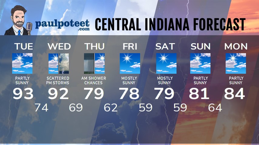
INDY SEVEN DAY FORECAST
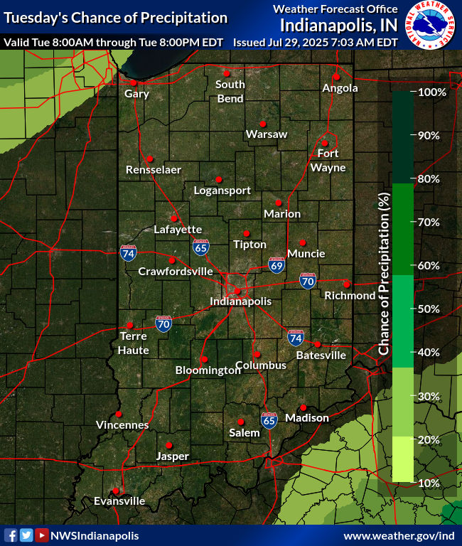
Today: Patchy dense morning fog. Then mostly to partly sunny, hot and humid. High 93.
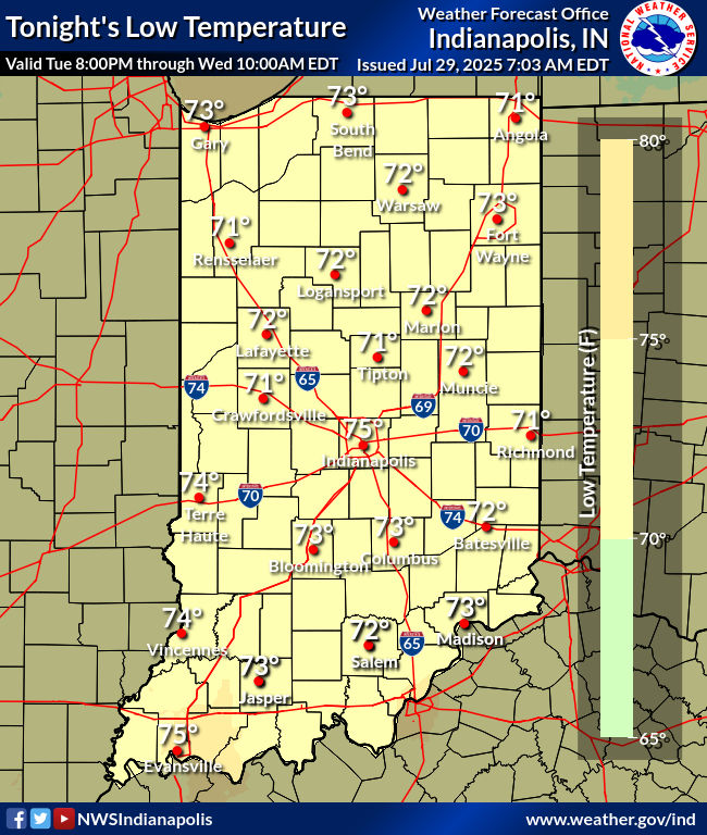
Tonight: Mostly clear. Low 74.
Wednesday: Partly sunny. Scattered afternoon showers and storms. High 92.
Wednesday Night: Scattered showers and storms. Low 69.
Thursday: Scattered morning showers and possibly storms, then decreasing clouds. High 79.
Thursday Night: Partly cloudy and much less humid. Low 62.
Friday: Mostly sunny. High 78.
Friday Night: Mostly clear. Low 59.
Saturday: Mostly sunny. High 79.
Saturday Night: Partly cloudy. Low 59.
Sunday: Partly sunny. High 81.
Sunday Night: Partly cloudy. Low 64.
Monday: Partly sunny. High 84.
Never miss me! Subscribe for free. My Huge Radar has real-time weather tracking, current temperatures, and severe weather watches and warnings. Get detailed Indiana conditions by clicking here. Click here to see my central Indiana 7-Day Forecast. Follow these links to get my forecasts for Lafayette, Muncie, Hendricks County, and Hamilton County. Need a second opinion? Click here for central Indiana National Weather Service forecasts. (Some charts via WeatherBELL.)


