HEADLINES
– Some showers and storms will be around again today, mainly in the morning.
– Very warm to hot and humid conditions continue through Tuesday, with cooler air arriving afterward.
– Additional showers and storms will be around with a frontal passage Tuesday into Wednesday
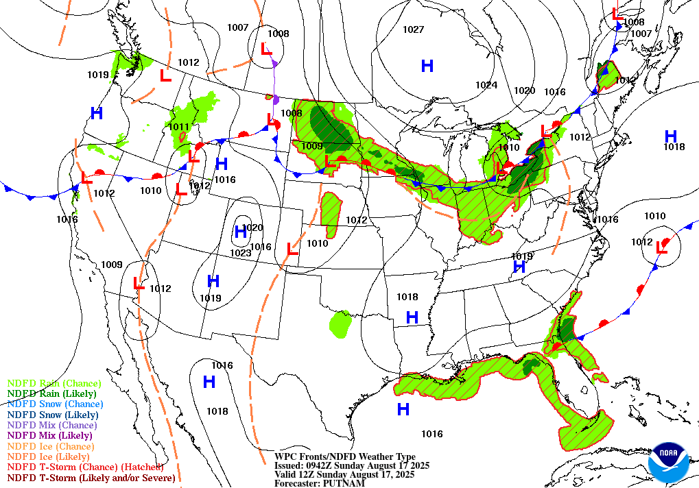
TODAY’S MAP
NWS TECHNICAL DISCUSSION
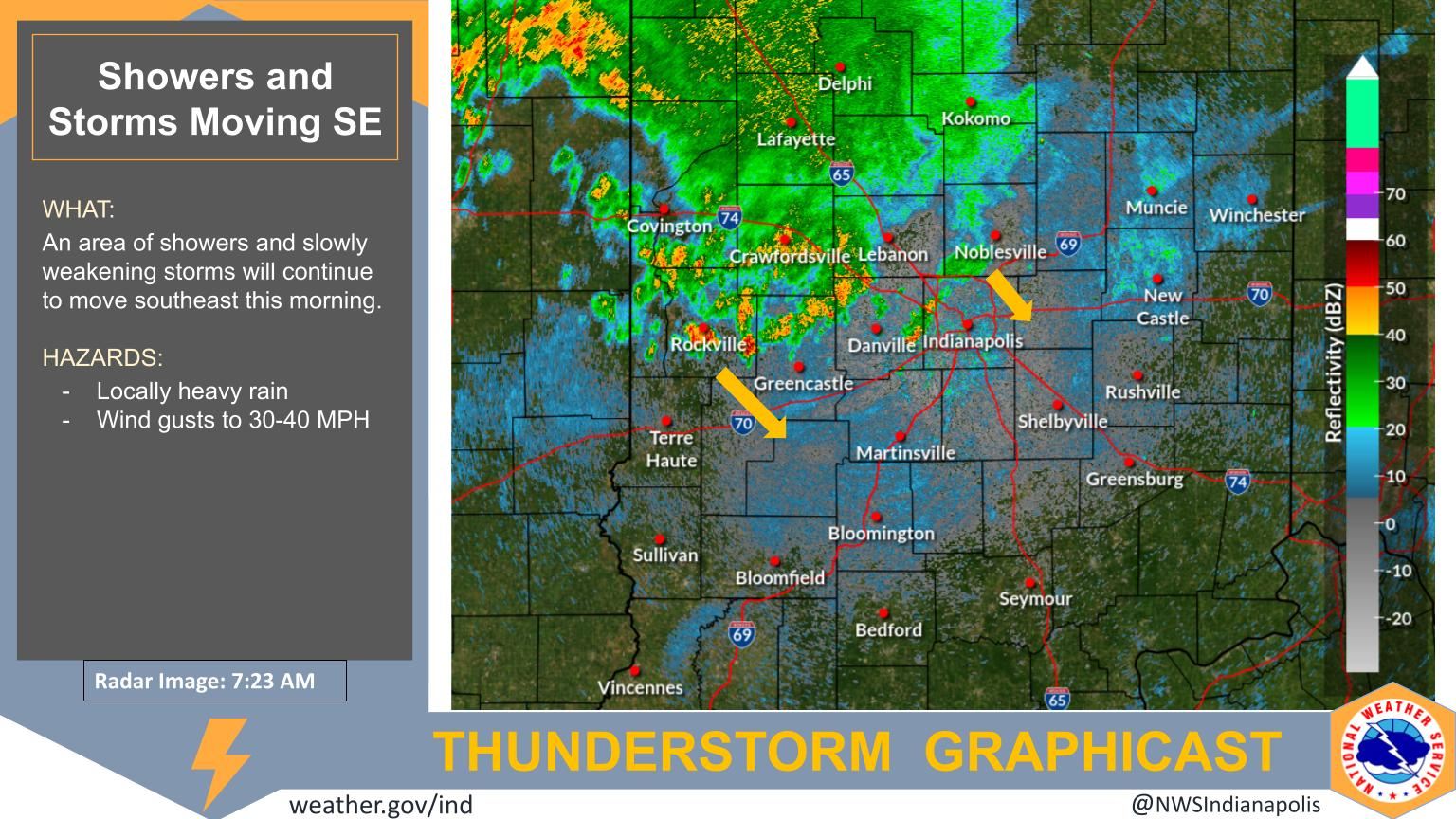
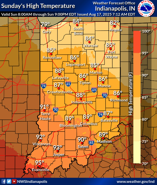
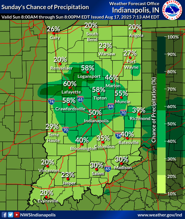
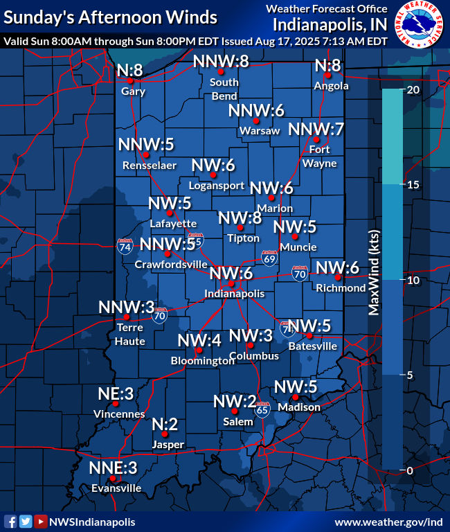
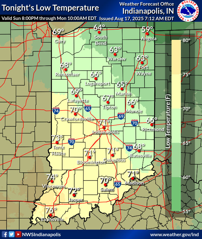
Convection across the southwestern forecast area will continue to
push south and out of the forecast area in a few hours.

Convection across northern Illinois and northern Indiana will also
continue to move southeast. Uncertainty is relatively high on how
much of this will be able to sustain itself as instability has been
used up by prior convection.

Will continue to monitor closely, but for now feel that the bulk of
this convection will remain across the northeast half of the area.
Will have highest PoPs there with lower PoPs elsewhere.

Today...

Scattered convection will persist into this morning, especially
across the northeast half of the area. Will keep chance PoPs there
with lower PoPs elsewhere.

Convection should then diminish by late morning. Clouds will thin
into the afternoon, allowing more instability to build. Boundaries
from the earlier convection may remain across the area, and models
are showing a synoptic surface boundary in the area as well. This
will be enough to keep some low PoPs around all areas this afternoon.

Severe parameters look low enough that severe storms are not
expected, but gusty winds and heavy rain remain possible with any
storm.

High temperatures will be impacted by residual cloud cover and
morning convection. Will continue to go cooler than guidance, with
highs in the middle 80s to lower 90s expected.

Tonight...

Believe that any afternoon convection will be pretty much done by
00Z, so will keep with a dry forecast. The upper high should nudge
in to keep any convection away from the area during the night.

Lows will be in the middle 60s to lower 70s.

&&

.LONG TERM (Monday through Saturday)...
Issued at 253 AM EDT Sun Aug 17 2025

Monday...

The upper ridge extending across the area should be enough to keep
the area dry on Monday. Very warm to hot and humid conditions will
persist thanks to the upper ridge, with highs in the upper 80s to
lower 90s.

Tuesday and Wednesday...

An upper trough will push the upper ridge to the west of central
Indiana. This north to northwest flow will allow a cold front to
move into the area, bringing chances for showers and thunderstorms.

There is continued uncertainty with the specifics. Hurricane Erin
could influence the upper pattern, which could slow down the
progression of the system. This would keep rain chances around
longer. Will have PoPs through Wednesday for at least parts of the
area.

Tuesday will remain hot with highs around 90 to the lower 90s, but
Wednesday will be cooler thanks to the front with highs in the 80s.

Thursday and beyond...

High pressure, and the brief return of the upper ridge, will help
keep the area dry through the end of the work week. Temperatures
will rebound into the middle and upper 80s by Friday.

Another upper trough will push the ridge west again for next weekend
and will bring another cold front into the area. Moisture looks
limited so will keep a dry forecast. Questions remain on the timing
of the front and the extent of the cooler air, but highs on Sunday
could cool into the lower 80s. Cooler than normal temperatures may
persist into next week.


Never miss me! Subscribe for free. My Huge Radar has real-time weather tracking, current temperatures, and severe weather watches and warnings. Get detailed Indiana conditions by clicking here. Click here to see my central Indiana 7-Day Forecast. Follow these links to get my forecasts for Lafayette, Muncie, Hendricks County, and Hamilton County. Need a second opinion? Click here for central Indiana National Weather Service forecasts. (Some charts via WeatherBELL.)


