…Rounds of severe thunderstorms with heavy rain possible over the
northern Plains and Upper Midwest today and Sunday…
…Hazardous heat in the Mid/Lower Mississippi Valley through early next
week…
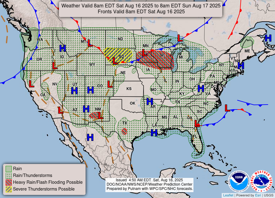
A frontal system is forecast to bring showers and thunderstorms from the
Pacific Northwest to the Northeast over the weekend, with chances for
isolated to scattered severe thunderstorms over the northern Plains and
Upper Midwest. The front will likely progress faster across the Northwest
and Northeast while remaining nearly stationary over the north-Central
U.S. as several waves of low pressure develop over the region. The slow
nature of the front and repeating rounds of storms will create a flash
flood threat from the northern Plains to the Upper Midwest, and isolated
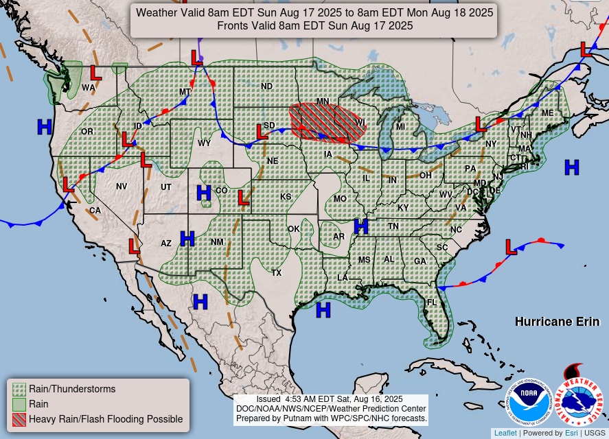
to scattered instances of flash flooding will be possible. By Monday, the
front should gain some southeastward momentum, and showers and storms will
shift into the Great Lakes region while the north-Central U.S. dries out.
Precipitation chances will also persist through the weekend for the
Southwest and Southeast. Monsoonal moisture across the Four Corners region
will support scattered showers and isolated thunderstorms, and a weak area
of low pressure and trailing frontal boundary lingering just off the
Southeast Coast will support scattered showers and thunderstorms across
Florida and along the Southeast Coast.
Due to expected precipitation and cloud cover, the West Coast and portions
of the Upper Midwest will likely see below normal temperatures this
weekend. Below normal temperatures may also nudge into the Northeast in
the wake of a cold front passage on Monday. Above normal temperatures are
forecast for the rest of the Central and Eastern U.S., with hazardous heat
possible in the Mid/Lower Mississippi Valley through the weekend and early
next week. High temperatures are forecast to range from the 90s to near
100 degrees with heat index values 105-110 degrees. This level of heat
will create Major to Extreme HeatRisk across the region, which could be
dangerous to anyone without adequate cooling and/or hydration.
Dolan
Graphics available at
https://www.wpc.ncep.noaa.gov/basicwx/basicwx_ndfd.php