…A tropical disturbance over south Texas will bring chances for heavy
rainfall over the region…
…Severe thunderstorms with heavy rain possible over the northern Plains
and Upper Midwest through the weekend…
…Hazardous heat from the Central Plains to Mississippi Valley this
weekend…
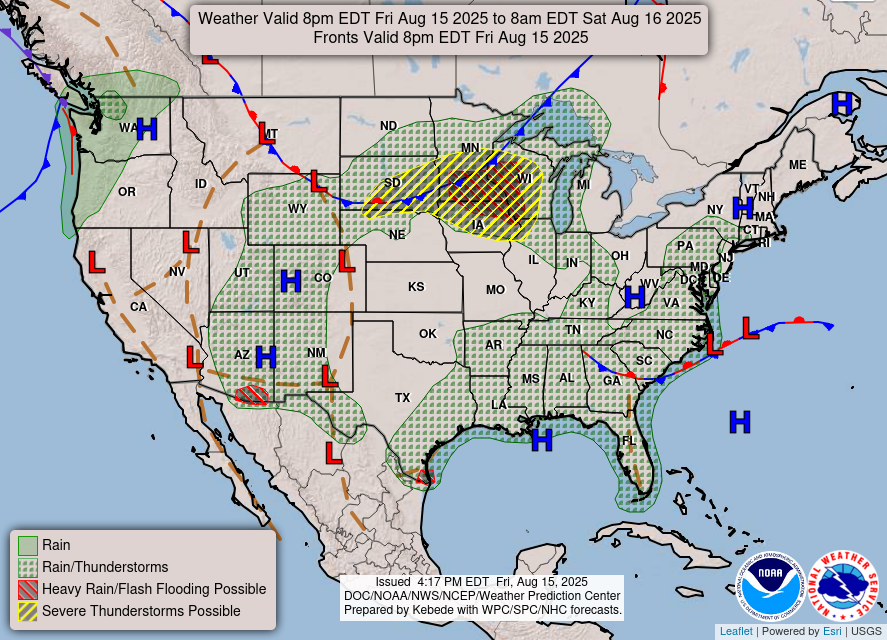
A tropical disturbance near south Texas will bring occasional moderate to
locally heavy rain today into Saturday. This disturbance should move
northwards into central and southeast Texas tonight bringing chances for
isolated to scattered flash flooding. Parts of southern Texas, including
Brownsville, is under a Slight Risk (2/4) for Excessive Rainfall.
Over the Great Plains and Upper Midwest, a slow-moving front will continue
to trek southward into the northern Plains and Upper Midwest. With the
warm, moist air and instability aloft, expect scattered severe
thunderstorms through the weekend. Storm Prediction Center has highlighted
the Upper Midwest with a Slight Risk (2/5) for severe thunderstorms this
afternoon into tonight. These storms have the potential to bring hail,
strong gusty winds, and heavy rain/flash flooding. As the cold front
slowly moves towards the Northeast by Sunday, expect scattered showers and
thunderstorms to develop over this area, bringing chances for locally
heavy rain and flash flooding.
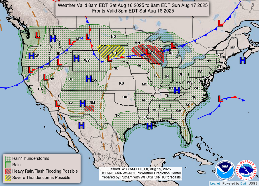
With the combination of the cold front moving into the Pacific Northwest,
moisture from an atmospheric river over Washington, and monsoon moisture
over the Southwest, chances for showers and thunderstorms will persist
through the weekend across the Four Corners and Pacific Northwest.
Fortunately, rainfall will be beneficial due to recent drought conditions
across the region. Therefore, risk for flash flooding will be marginal.
Above normal temperatures will continue to push over the Central Plains
and Mississippi Valley over the next few days. With temperatures expected
to reach the upper 90s to low 100s this weekend, parts of the Midwest and
Central Plains are under a Major to Extreme HeatRisk, which will be
hazardous for those without effective cooling/hydration and those who are
sensitive to heat. Otherwise, a cold front will continue to move over
western U.S., allowing for cooler than average temperatures to continue
through the weekend over California, the Great Basin, and Pacific
Northwest.
Oudit
Graphics available at
https://www.wpc.ncep.noaa.gov/basicwx/basicwx_ndfd.php