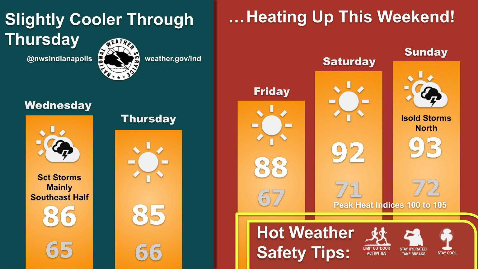
HEADLINES
– Scattered afternoon showers today. Storms are possible roughly east of I-69.
– A little less humid later tonight, Thursday, into Friday morning.
– Humidity returns Friday afternoon into the weekend, with highs back up around 90.
– Less humidity and normal high temps starts a week from today.
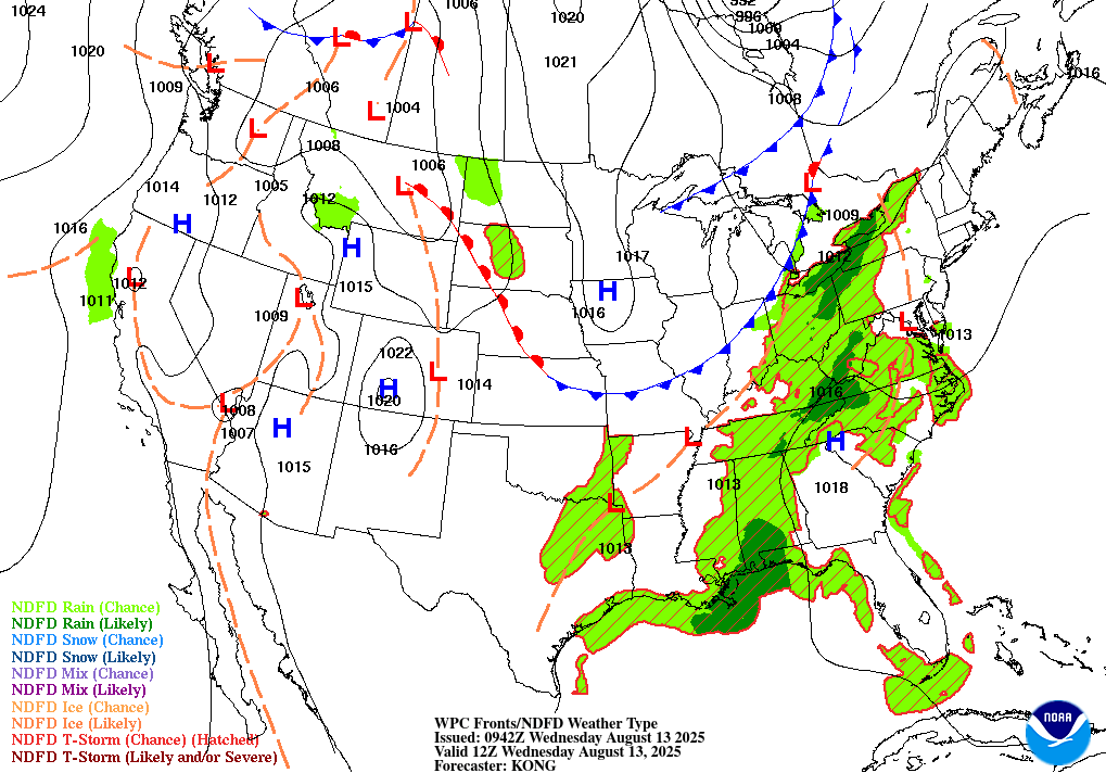
TODAY’S MAP
NWS TECHNICAL DISCUSSION
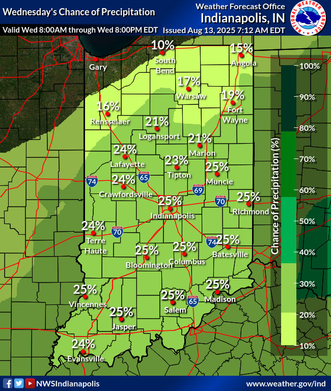
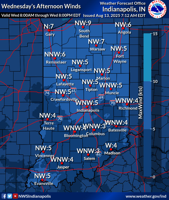
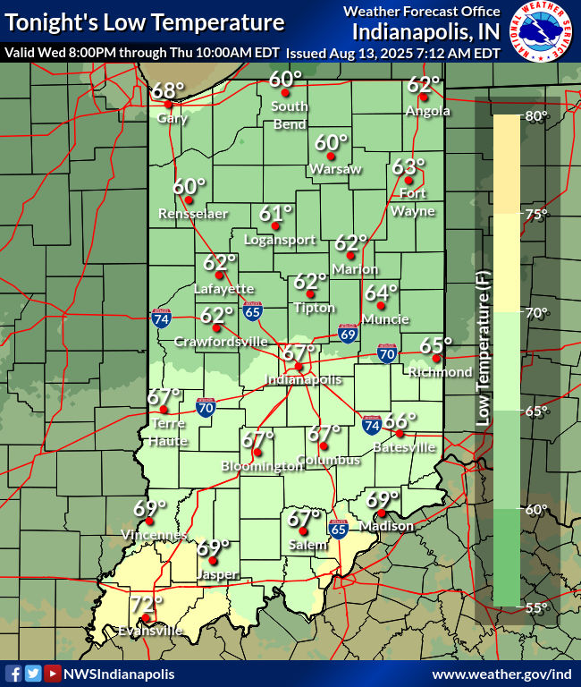
Precipitation has diminished across central Indiana as forcing from
a passing shortwave has shifted east. Clearing skies and lighter
winds along with earlier rainfall will likely lead to fog
development. Some locations are already reporting minor visibility
reductions. There is potential for locally dense fog, especially
over southwest portions of central Indiana where the heaviest rain
fell. A low stratus deck is also expected to develop which could
help locally dense fog linger longer during the morning before
daytime heating eventually mixes it out.

Drier air filtering into the region today will help to gradually
clear out clouds. However, guidance depicts weak convergence along a
lingering low-level boundary and sufficient PBL moisture in place.
This combined with daytime heating may promote isolated showers or
storms, primarily during the afternoon. The boundary is only
expected to make slight southward progress into the overnight hours.
Marginal low-level convergence could be enough to promote a few
light showers, but very weak forcing limits confidence greatly. Will
keep a dry forecast tonight for now.

There is a low chance for patchy fog to develop tonight as winds
become very light. Drier air filtering in from the north should
mostly limit fog potential though. Look for northwest surface flow
and sct-bkn clouds to help keep highs slightly cooler in the 80s.
Lowering dewpoints will also result in cooler temperatures
overnight. Expect lows in the 60s.

&&

.LONG TERM (Thursday through Tuesday)...
Issued at 257 AM EDT Wed Aug 13 2025

After a slightly cooler day on Thursday...the heat and humidity will
return beginning Friday and persisting into early next week as deep
ridging aloft centers over the region. Little to no threat for
convection will exist Friday into much of the weekend with the the
eastward expansion of the upper ridge and presence of a
strengthening mid level cap. Uncertainty increases beyond early next
week with the potential for a developing blocky pattern aloft with
upper troughs on the coasts and ridging refocusing over the central
Plains as Tropical Storm Erin moves towards the western Atlantic
basin as a hurricane. A deepening of the upper level trough over the
Canadian Maritimes could essentially force a retrograde to the
ridging by the middle of next week which would bring an end to the
upcoming heat wave.

Weak high pressure will build into central Indiana from the north on
Thursday with increasingly drier air through the column. The
presence of a wavy upper flow regime however could provide just
enough forcing aloft to generate a stray shower or storm across the
southeast half of the forecast area by the afternoon despite the
initial surge of warming aloft contributing to the onset of capping
in the mid levels. Any convection that does form will diminish
quickly during the evening.

The upper ridging over the central U S will begin its eastward shift
into the Ohio Valley on Friday...bringing multiple days of heat and
humidity that could rival the late July heat wave in terms of temps
and heat indices. Highs will rise into the lower and mid 90s by the
weekend and early next week with dewpoints recovering into the 70s.
Peak heat indices in the afternoons Saturday through Monday will
rise into the 100 to 105 degree range over parts of the forecast
area. With a strong mid level cap under the core of the
ridge...convective development will be largely mitigated for Friday
and Saturday with only isolated storms at best limited to peak
heating hours of the afternoon and early evening by Sunday and
Monday.

Low confidence in the forecast beginning next Tuesday through much
of the rest of next week. The potential retrograde of the ridge into
the middle of next week would allow for a frontal boundary to push
further south into the Ohio Valley by Tuesday and Wednesday with
increasing convective coverage and would likely bring an end to the
multi-day heat wave upcoming for the weekend and early next week.
Erin remains a wildcard as its location and strength in the western
Atlantic basin next week could delay any substantial pattern changes
beyond what model guidance is suggesting.
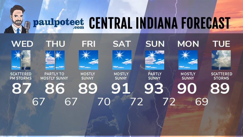
INDY SEVEN DAY FORECAST
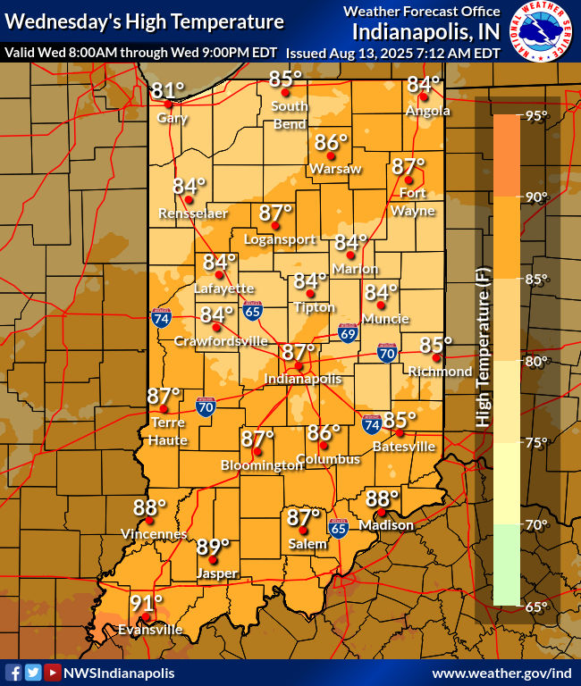
Today: Some morning sunshine. Scattered later afternoon showers and possibly some thunder. High 87.
Tonight: Decreasing clouds and not quite as humid. Low 67.
Thursday: Partly to mostly sunny. High 86.
Thursday Night: Mostly clear. Low 67.
Friday: Mostly sunny. Humidity increases again in the afternoon. High 89.
Friday Night: Mostly clear. Low 70.
Saturday: Mostly sunny. High 91.
Saturday Night: Mostly clear. Low 72.
Sunday: Partly sunny. High 93.
Sunday Night: Partly cloudy. Low 72.
Monday: Partly sunny. High 90.
Monday Night: Partly cloudy. Low 69.
Tuesday: Partly to mostly cloudy, with scattered showers. High 89.
Never miss me! Subscribe for free. My Huge Radar has real-time weather tracking, current temperatures, and severe weather watches and warnings. Get detailed Indiana conditions by clicking here. Click here to see my central Indiana 7-Day Forecast. Follow these links to get my forecasts for Lafayette, Muncie, Hendricks County, and Hamilton County. Need a second opinion? Click here for central Indiana National Weather Service forecasts. (Some charts via WeatherBELL.)


