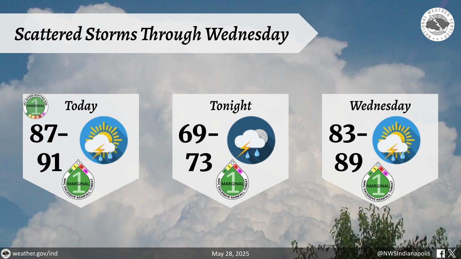
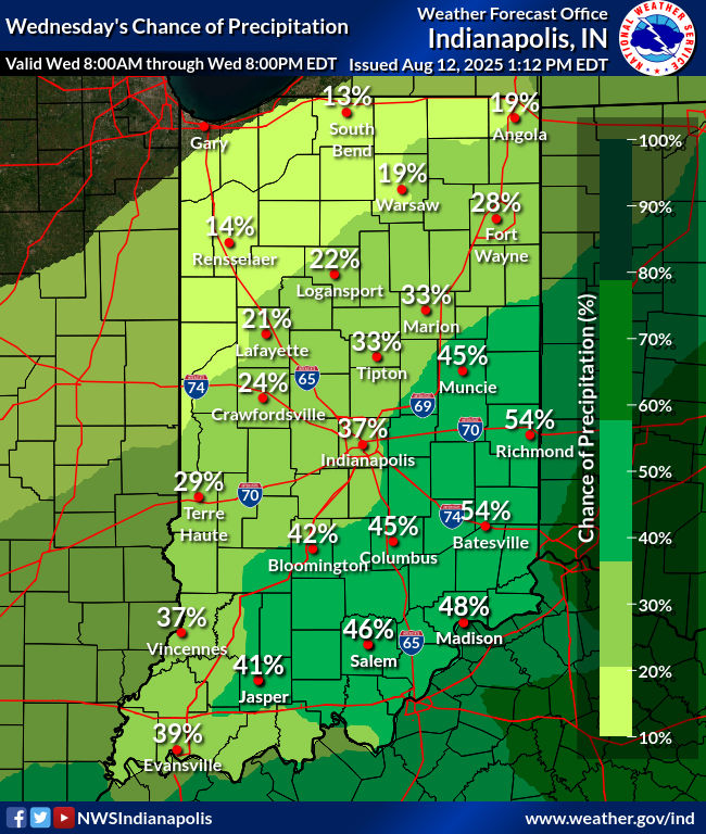
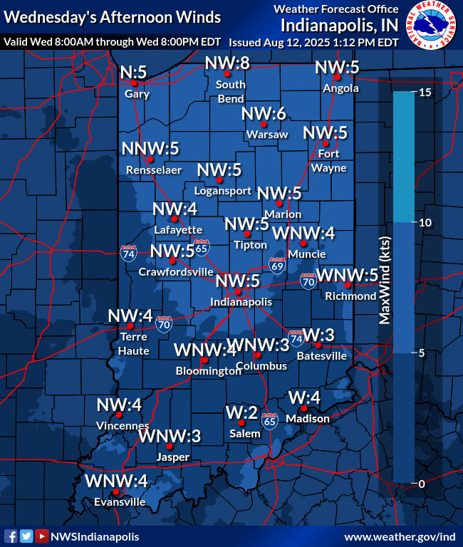
Moist southerly flow and strong surface heating along with upper air support is providing the fuel needed for scattered showers and thunderstorms ahead of a cold front approaching Illinois and eventually Indiana. Some storms may become strong to marginally severe, with the chief threat being gusty winds up to 50 mph and intense rainfall. Storm movement is northeast at about 15 mph. Coverage is extended to slowly diminish as we go into the overnight hours.

Never miss me! Subscribe for free. My Huge Radar has real-time weather tracking, current temperatures, and severe weather watches and warnings. Get detailed Indiana conditions by clicking here. Click here to see my central Indiana 7-Day Forecast. Follow these links to get my forecasts for Lafayette, Muncie, Hendricks County, and Hamilton County. Need a second opinion? Click here for central Indiana National Weather Service forecasts. (Some charts via WeatherBELL.)


