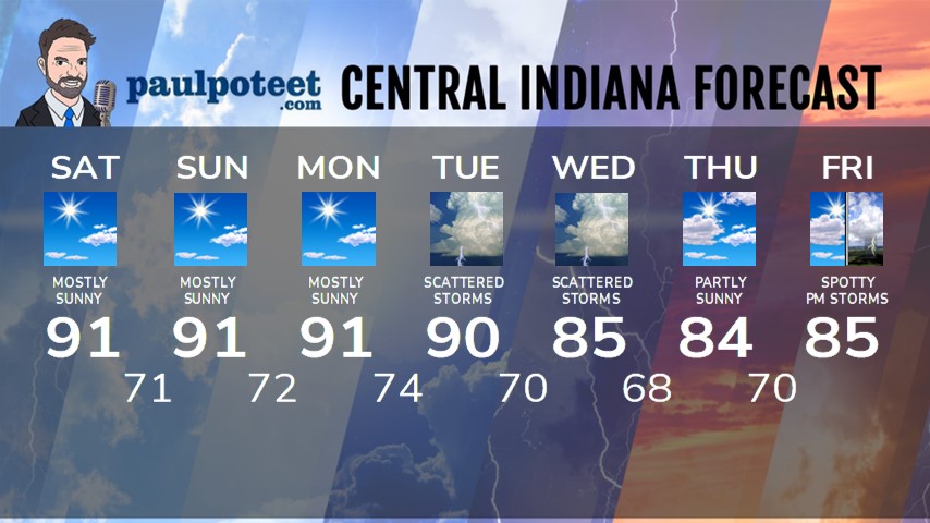
HEADLINES
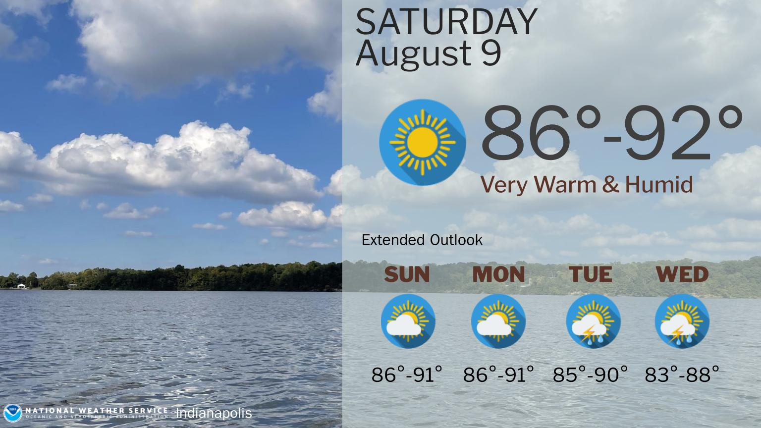
– Hot and humid, with no rain through Monday.
– Shower and storm chances Tuesday and Wednesday.
– Temps stay above average through *next* weekend!
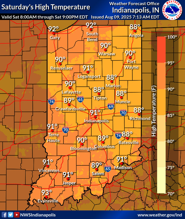
TODAY’S MAP
NWS TECHNICAL DISCUSSION
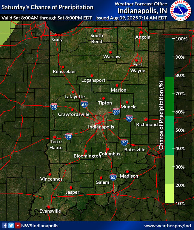
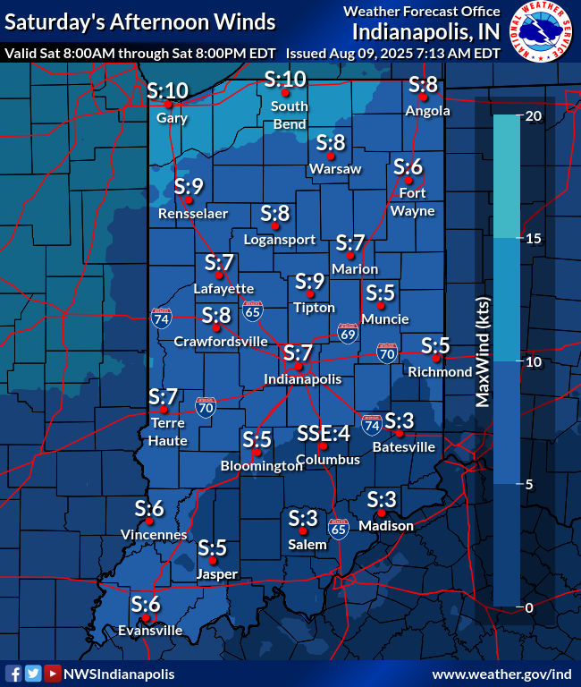
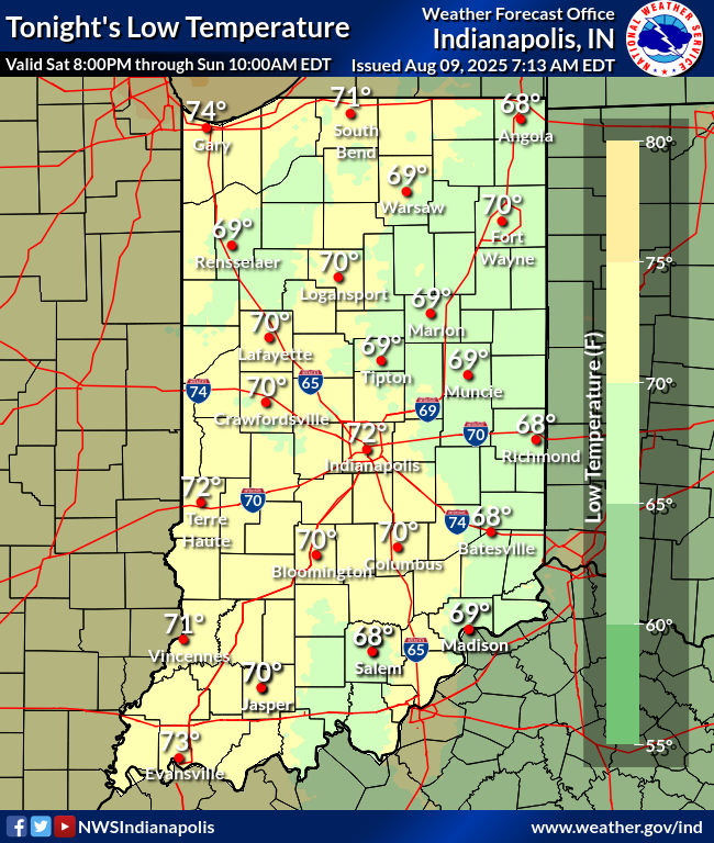
Clear skies early this morning with light southeast winds as ridging
aloft and at the surface holds serve across the Ohio Valley. 06Z
temperatures were in the low and mid 70s with a muggy airmass in
place.

Today looks to be a near carbon copy of what was experienced Friday
as broad ridging remains across much of the eastern part of the
country maintaining a warm and humid airmass with dry conditions
across the forecast area. The presence of the ridging aloft will
block a significant eastward movement to a stronger upper low
drifting through the northern Plains. A cold front will shift east
into the upper Midwest and Missouri Valley by late today and
tonight. The boundary will be a focal point for robust convective
development but due to the ridging over the region will not make any
further progress eastward through the short term.

Localized shallow ground fog is a possibility through daybreak but
overall coverage will be lower than Friday morning as the boundary
layer has had a full day to dry out from convection earlier this
week. Diurnal cu will develop for the afternoon but should remain
generally flat and scattered with a mid level cap persisting over
the region. Modest instability will again develop for the afternoon
but the presence of the cap with warm and subsident air within the
mid levels will mitigate any potential for isolated convection
during peak heating. Model soundings do show a well mixed boundary
layer with dry adiabatic flow for the afternoon which may enable
slightly drier air to be drawn to the surface during peak heating
while also subtly increasing southerly winds.

Cu and winds will diminish this evening with loss of heating setting
the stage for another muggy night with near calm surface winds.
Convective clusters developing along the boundary to the northwest
mentioned above will not have any impact locally across central
Indiana but may see a subtle increase in high clouds from the storms
move into the region by Sunday morning.

Temps...low level thermals support similar temperatures to Friday
with highs in the upper 80s to lower 90s. Lows tonight will be
around 70.

&&

.LONG TERM (Sunday through Friday)...
Issued at 234 AM EDT Sat Aug 9 2025

A stagnant pattern aloft will develop across the eastern half of the
country as ridging sits in place into the first part of the week and
blocks a northern stream trough from expanding southeast. This will
maintain a very warm and humid airmass across the Ohio Valley over
the next few days. The upper level flow will transition to more of a
quasi-zonal regime throughout the upcoming week which will enable
weak waves aloft to drop further south into the region with daily
threats for scattered convection focused mainly from Tuesday going
forward into next weekend.

Sunday through Monday Night

A typical humid midsummer airmass will persist across the Ohio
Valley with ridging aloft and at the surface with daily highs/lows
within a few degrees either side of 90 and 70 degrees respectively
both Sunday and Monday. The heating will breed moderate instability
levels each day through Monday despite a lingering mid level cap.
There will be a nonzero convective threat but it will be difficult
to see much more than a few stray showers or storms considering the
mitigating factors mentioned above. Will continue with a dry
forecast Sunday but as the cap weakens slightly by Monday low chance
pops for isolated storms are warranted by the afternoon.

Tuesday through Friday

The flattening of the upper level flow will enable upper level waves
to track further south with scattered convection developing each day
and focusing during the peak heating hours of the afternoon and
early evening. While run to run consistency amongst the model suite
remains less than desired...the strongest of the waves aloft will
come through the area Tuesday into Wednesday with the best
chances for storms in the extended likely coming both days. The
main convective risks will be heavy rainfall and localized
flooding as a lack of substantial shear will ensure slow movement
to storms that will pulse up and down in intensity. There is
always the potential for a cell to strengthen enough briefly to
produce localized downbursts as the cores collapse but that is
likely to remain a secondary concern throughout the period.

Expect virtually no change in airmass all next week and likely into
the weekend as well. Muggy conditions will persist with highs in the
mid and upper 80s and dewpoints likely creeping up a bit into the
lower 70s. Signs continue to increase in little to no change in the
pattern for next week beyond the 7 day period into the following
week as cooler and drier air remains bottled up well to the north of
central Indiana.
Never miss me! Subscribe for free. My Huge Radar has real-time weather tracking, current temperatures, and severe weather watches and warnings. Get detailed Indiana conditions by clicking here. Click here to see my central Indiana 7-Day Forecast. Follow these links to get my forecasts for Lafayette, Muncie, Hendricks County, and Hamilton County. Need a second opinion? Click here for central Indiana National Weather Service forecasts. (Some charts via WeatherBELL.)


