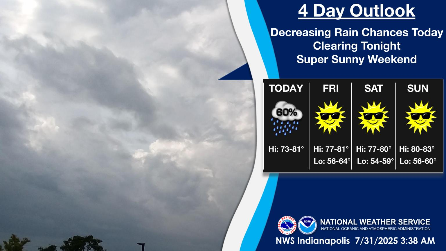
HEADLINES
– Widespread 1-2″ rainfall overnight and early morning. Over 3″ fell in Broad Ripple!
– Quieter the rest of the day. Humidity and clouds decrease tonight.
– Beautiful weekend! Rain chances return late Monday night. Humidity returns *next* weekend.
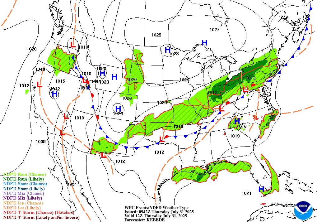
TODAY’S MAP
NWS TECHNICAL DISCUSSION
The bulk of the rain will exit the forecast area during the morning
hours which coincides with the LLJ weakening and the front pushing
southeastward. Some residual light rain on the backend of the system
will continue through at least the late morning if not early
afternoon hours, but otherwise much more pleasant conditions will be
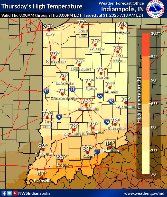
working into the forecast area with steady-state temperatures in the
low to mid 70s for all but the far southern counties along with
gradually dropping dew points.
Tonight.
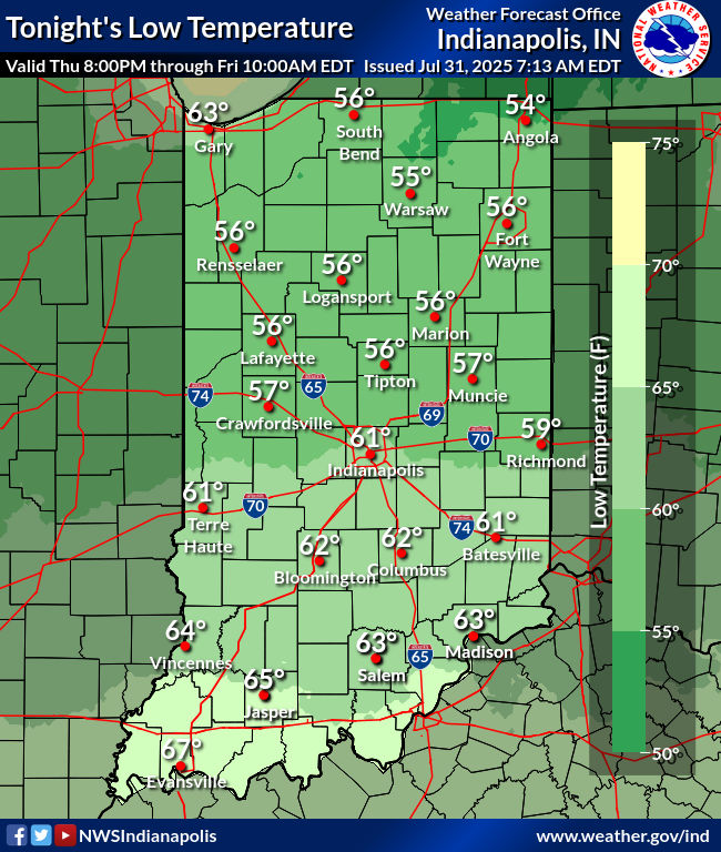
Surface moisture will continue to decrease through the night which
will help to bring overnight lows into the upper 50s to low 60s
along with decreasing cloud cover as the drier air advects in aloft
and the front continues to push further away. Can`t rule out a stray
shower in the far southeastern counties during the early overnight,
but have fairly good confidence in dry weather across the forecast
area.
&&
.LONG TERM (Friday through Wednesday)…
Issued at 315 AM EDT Thu Jul 31 2025
Friday through Sunday…
Models still remain in track for a fantastic weather weekend ahead
with mostly sunny/mostly clear skies and much lower humidity. Strong
ridging upstream of Indiana over the Rockies is still expected to
lead to northwest flow and lee side subsidence across the Upper
Midwest spilling into the Ohio Valley. This will allow for the
generation of a strong and large area of surface high pressure over
the Great Lakes that will dominate the weather for the weekend
across the northeast quadrant of the nation. Forecast soundings
through the weekend show a dry column with subsidence with a dry and
cool easterly surface flow. Thus the continued as advertised
pleasant weekend remains on track with highs in the upper 70s and
lower 80s, low humidity and lows around 60.
Monday through Wednesday…
Rain chances will need to be continued during this period as several
factors continue to remain in play as our pleasant surface high
departs to the east. The first factor contributing to this will be
the development of southerly surface winds and the arrival of more
humid air as the large surface high departs. The second factor is
aloft, as models suggest a broad upper trough pushing toward Indiana
on Monday and arriving on Tuesday. A wave of forcing dynamics within
this flow is suggested to arrive on Monday afternoon and a second
wave is suggested to arrive on Tuesday afternoon. Forecast soundings
suggest periods of deep saturation through this period. By
Wednesday, the GFS has developed the broad trough over the region in
to an upper low over the region. Continued warm and moist southerly
surface flow also is suggested to remain in place. Thus daily
chances for showers and thunderstorms will continue to be needed.
INDY SEVEN DAY FORECAST
Today: Mostly cloudy, with scattered showers, mainly in the morning. Some thunder is also possible. Cooler. High 74.
Tonight: Partly cloudy and much less humid. Low 60.
Friday: Mostly sunny. High 78.
Friday Night: Mostly clear. Low 58.
Saturday: Mostly sunny. High 79.
Saturday Night: Partly cloudy. Low 58.
Sunday: Mostly sunny. High 82.
Sunday Night: Partly cloudy. Low 64.
Monday: Partly sunny. High 83.
Monday Night: Partly cloudy. Scattered showers and storms after midnight. Low 65.
Tuesday: Partly sunny, with scattered showers and storms. High 82.
Tuesday Night: scattered showers and storms. Low 65.
Wednesday: Partly sunny, with scattered showers and storms. High 83.

Never miss me! Subscribe for free. My Huge Radar has real-time weather tracking, current temperatures, and severe weather watches and warnings. Get detailed Indiana conditions by clicking here. Click here to see my central Indiana 7-Day Forecast. Follow these links to get my forecasts for Lafayette, Muncie, Hendricks County, and Hamilton County. Need a second opinion? Click here for central Indiana National Weather Service forecasts. (Some charts via WeatherBELL.)


