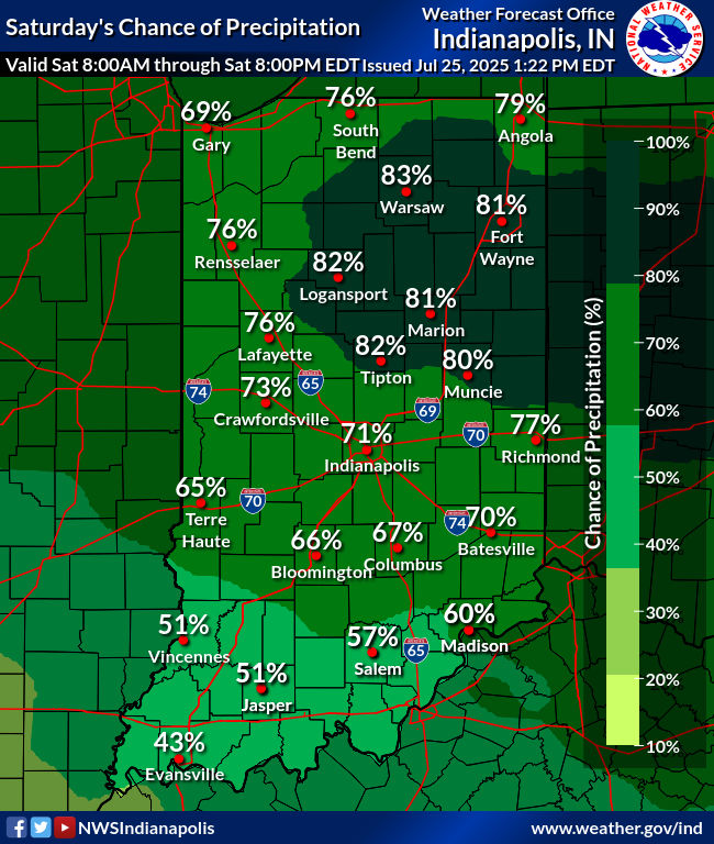
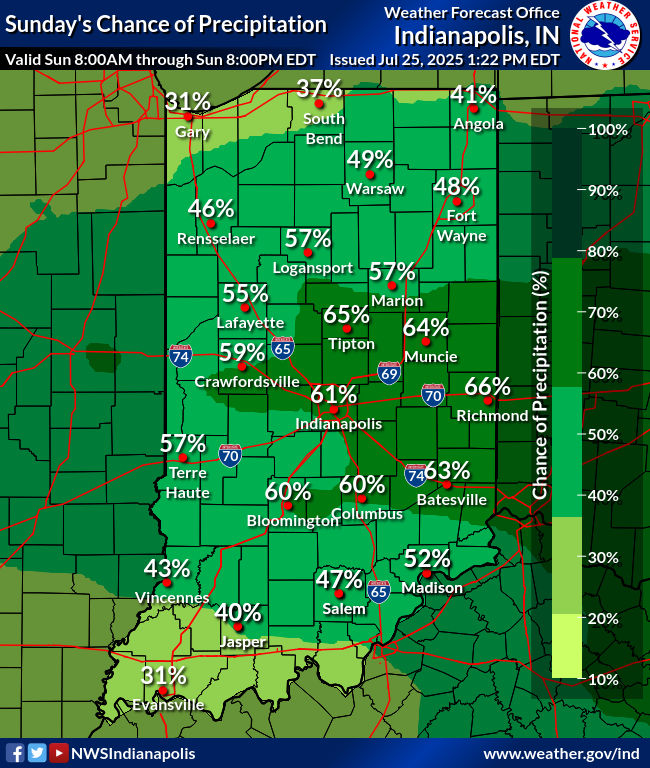
Showers and storms with locally torrential rainfall and isolated wind gusts to 40 mph have now retreated to the northern quarter of the state. Scattered showers and storms return for Saturday, especially in the northern half of the state, where storms could produce damaging wind gusts. (It’s a level one out of five risk.)

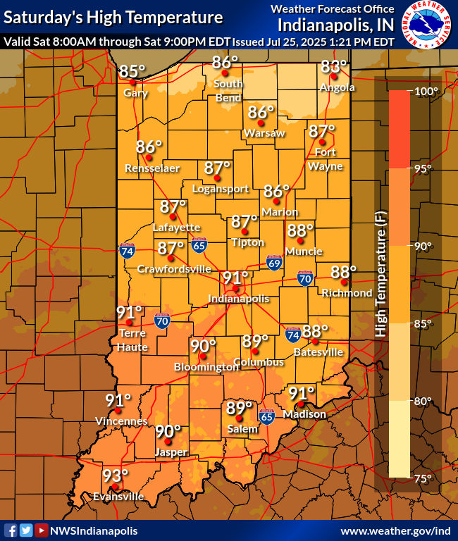
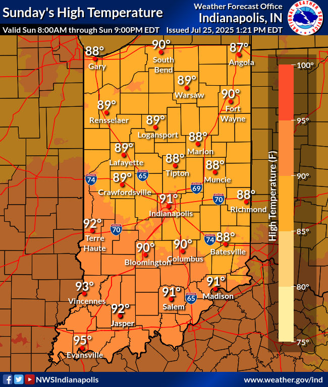
From I-70 southward…a few less clouds spells more heat. Humidity continues to run high, so the Heat Advisory is extended.

Here’s my forecast:

Never miss me! Subscribe for free. My Huge Radar has real-time weather tracking, current temperatures, and severe weather watches and warnings. Get detailed Indiana conditions by clicking here. Click here to see my central Indiana 7-Day Forecast. Follow these links to get my forecasts for Lafayette, Muncie, Hendricks County, and Hamilton County. Need a second opinion? Click here for central Indiana National Weather Service forecasts. (Some charts via WeatherBELL.)


