HEADLINES
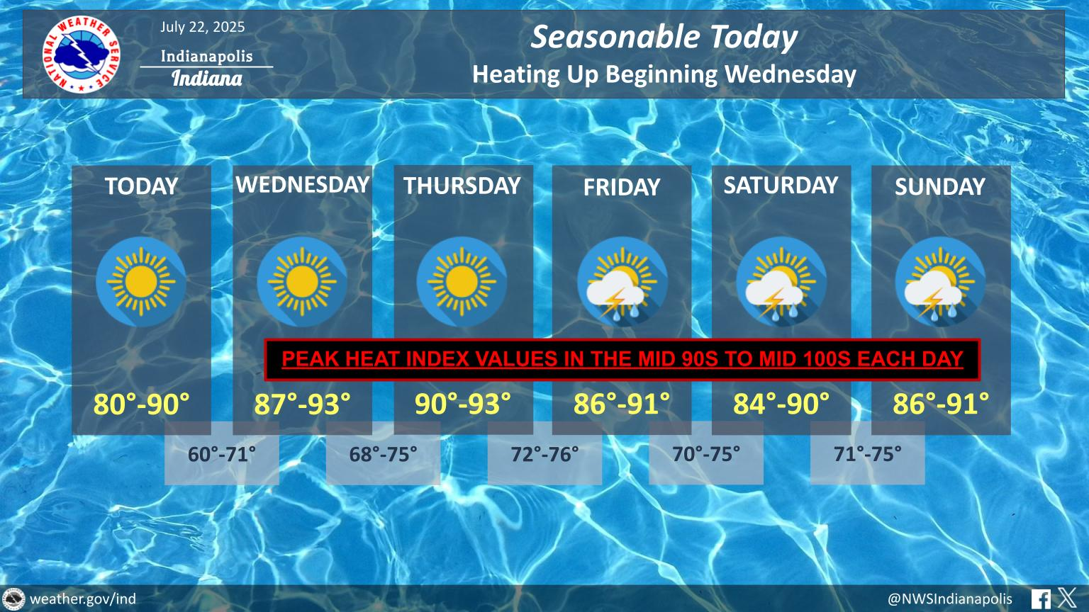
– Beautiful day ahead!
– Heat Advisory for west central Indiana Wednesday afternoon.
– Turning hotter beginning Wednesday. Heat index 100-ish by Thursday.
– Storm chances return Friday into the weekend.
TODAY’S MAP

NWS TECHNICAL DISCUSSION
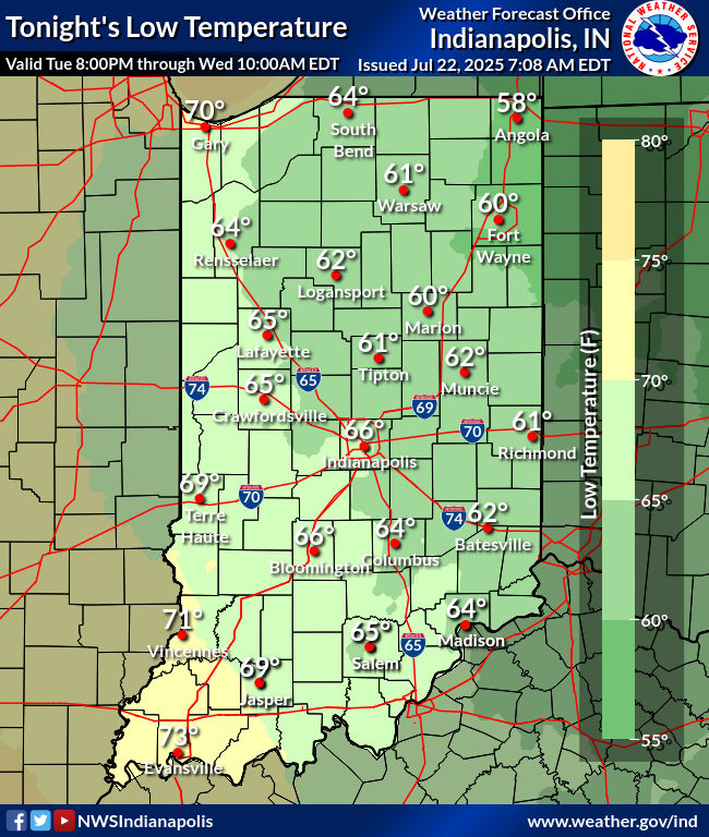
A fairly average midsummer day is expected across central Indiana
today, as upper level ridging begins to strengthen over the
Mississippi and lower Ohio valleys. This ridge will bring dry
weather and plentiful sunshine to the area today, with light east or
east-southeasterly winds owing to surface high pressure over Ontario.

Highs today will be near normal, in the mid to upper 80s. Decent
radiational cooling conditions tonight will bring lows down into a
broad range from around 60 in the northeast to the low 70s in the
southwest, in keeping with the fairly wide dewpoint gradient that
will remain in place. Some patchy fog may occur, particularly in
valleys and other favored areas, or the locations that have received
the most rainfall in recent days.

&&

.LONG TERM (Wednesday through Monday)...
Issued at 323 AM EDT Tue Jul 22 2025

A transition to hot and humid weather remains the expectation this
week as ridging builds overhead. Ensemble guidance shows 500mb
heights roughly 1-2 standard deviations above the mean which, while
not excessive, will push temperatures above normal for much of the
long term, in the upper 80s to low 90s.

This by itself is not unusual, but as southerly/southwesterly
surface flow resumes beginning Wednesday, dewpoints are expected to
rise back into the 70s, frequently well into the mid 70s with even
isolated upper 70s readings not out of the question. Guidance is
well clustered on this, with even NBM 5th percentile dewpoints at or
above 70 across central Indiana most of the long term period. This
will additionally be supported by the recent rains, along with very
healthy vegetation boosting low level moisture through significant
evapotranspiration.

This combination of warmth and high dewpoints will bring peak
afternoon heat index values to near or in excess of 100 degrees on
several days during the long term, with Thursday likely to be the
worst of these days across all of central Indiana.

Advisory criteria will be approached or perhaps briefly exceeded in
the western portion of the forecast area on Wednesday, and in
collaboration with neighbors have issued a Heat Advisory there for
Wednesday afternoon. There is a strong chance one will be necessary
everywhere on Thursday, but for the sake of messaging clarity will
start with Wednesday for now.

Beyond Thursday, the picture becomes a little murkier with respect
to heat as the ridge broadens and retrogrades slightly through the
weekend into next week, placing central Indiana in a northwest flow
regime, and, along with the approach of a boundary, reintroduces
thunderstorm chances to the forecast. Convection may significantly
impact daytime temperatures, and thus increase the uncertainty of
the expected heat indices.

Thunderstorm chances will be highest Friday and Saturday with the
boundary sagging toward the area and beginning to wash out, but the
very moist and warm airmass will continue to have the potential for
convection at times through the weekend and into early next week,
though with low predictability given the nebulous and mesoscale-
dependent forcing mechanisms in play. Severe storms cannot be ruled
out during the long term given the anticipated pattern, which is
capable of producing multiple QLCSs along the periphery of the
ridge, but the predictability on this is, just as with the storm
chances themselves, quite low.
INDY SEVEN DAY FORECAST
Today: Mostly sunny. High 86.
Tonight: Mostly clear. Low 65.
Wednesday: Mostly sunny. Humidity increases. High 91.
Wednesday Night: Mostly clear. Low 72.
Thursday: Partly sunny. High 93.
Thursday Night: Partly cloudy. Low 75.
Friday: Partly sunny. Scattered showers and storms. High 90.
Friday Night: Partly cloudy. Scattered showers and storms. Low 73.
Saturday: Partly sunny. Scattered showers and storms. High 88.
Saturday Night: Partly cloudy. Low 73.
Sunday: Partly sunny. Spotty showers and storms. High 90.
Sunday Night: Partly cloudy. Low 73.
Monday: Mostly sunny. High 91.


Never miss me! Subscribe for free. My Huge Radar has real-time weather tracking, current temperatures, and severe weather watches and warnings. Get detailed Indiana conditions by clicking here. Click here to see my central Indiana 7-Day Forecast. Follow these links to get my forecasts for Lafayette, Muncie, Hendricks County, and Hamilton County. Need a second opinion? Click here for central Indiana National Weather Service forecasts. (Some charts via WeatherBELL.)


