HEADLINES
– Strong to severe storms Saturday afternoon, including the potential for flooding.
– Strong to severe storms also possible Sunday.
– Storm frequency decreases week, as head and humidity increase.
– Hazardous heat Tuesday through Friday of next week. Triple digit head indices.
SATURDAY SPOTLIGHT
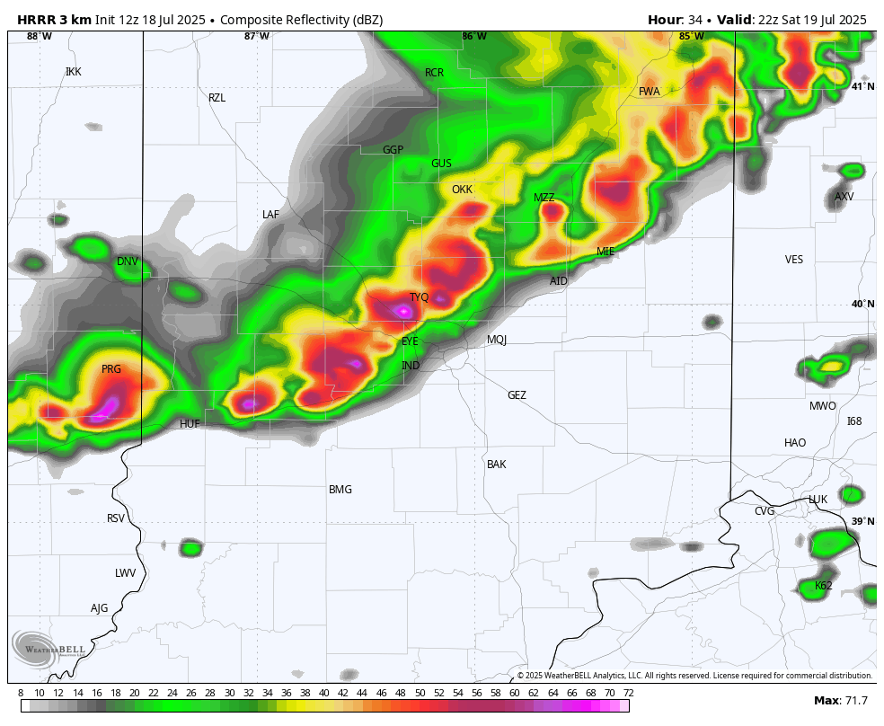
Computer-modeled radar for late Saturday afternoon.
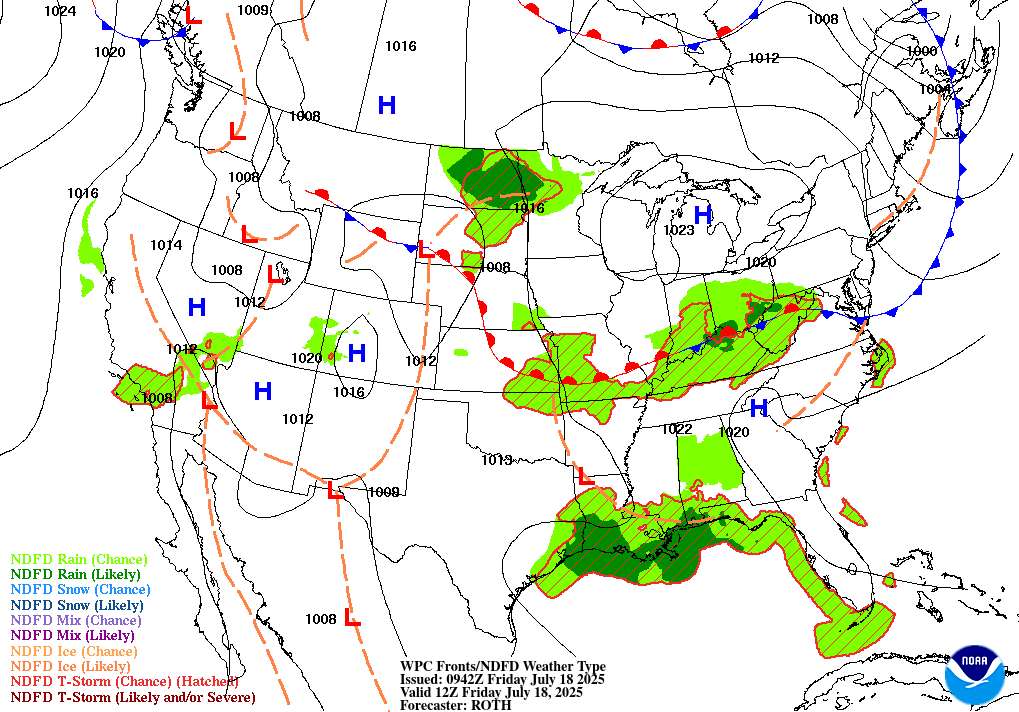
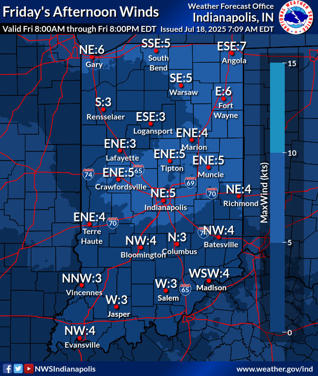
TODAY’S MAP
NWS TECHNICAL DISCUSSION
The primary surface boundary is now along southern portions of the
forecast area and should slowly move southward throughout the day.
By the time convective temperatures are reached this afternoon, the
boundary should be far enough south for a majority of the forecast
area to remain dry. This is also thanks to weak shortwave ridging
between 850-700mb, keeping any non-boundary forced convection for
developing. For now a 10-25% PoP has been included across Vincennes
to Seymour with still some uncertainty on how far south the boundary
will reach prior to the afternoon.

Overnight, low level winds will become stronger out of the
southwest, leading to some potential of isentropically endured showers
and embedded thunderstorms. This is currently expected to occur
between 08-14Z, but there is still some spread in the ensemble
guidance as far as timing.

The next item on the horizon is a growing likelihood of an organized
MCS instating over the northern Mississippi Valley midday Saturday,
reaching central Indiana by the early to mid afternoon. In the event
this does develop, increasing mid to upper level winds out of the
WNW along with a deep buoyancy profile could lead to a well
organized cold pool along with the potential for damaging wind
gusts. Due to the combination of morning convection along with an
approaching MCS in the mid-afternoon, temperatures gains are likely
to be strongly hampered, with Saturday`s highs expected to remain in
the mid 80s.

&&

.LONG TERM (Saturday through Thursday)...
Issued at 308 AM EDT Fri Jul 18 2025

With a baroclinic zone fluctuating across the region and an
extremely moist airmass in place, characterized by precipitable
water values frequently near or in excess (sometimes well in excess)
of two inches, or near climatological maximum, the threat for
thunderstorms will remain relatively high much of the time through
the late weekend into the first half of the coming work week, though
uncertainty regarding details in any one period remains seasonably
high, given significant low-predictability mesoscale dependencies
that grow with time.

The region will be positioned on the periphery of the broad
subtropical ridge to our south throughout this time frame, or prime
location for multiple rounds of convection riding the ridge. Given
the high instability anticipated, the southward encroachment of an
enhanced belt of the prevailing westerlies back into the Great Lakes
region will provide at least modest shear on most days, and may
present multiple opportunities for strong to severe storms in the
coming days, though basically each day will present the threat for
very heavy rainfall and localized flooding given the potential for
repeated rounds of storms on already fairly damp ground across much
of the area.

For the latter part of the work week, modest strengthening of the
upper ridge into the region will lower, though not eliminate, the
thunderstorm chances. These chances will be far more diurnally
driven, however, as major forcing mechanisms for ascent will be
shuttled northward along with the jet, and convective activity will
be dependent primarily on diurnal heating and the persistent
extremely humid airmass, which, given we are in the heart of
evapotranspiration season, could see dewpoints well into the upper
70s.

These dewpoints, along with high temperatures that may breach the
90s across all or part of the area from Tuesday onward, will have
the potential to produce dangerous afternoon peak heat index values
in excess of 100, perhaps as high as 105-110 late in the week.
INDY SEVEN DAY FORECAST
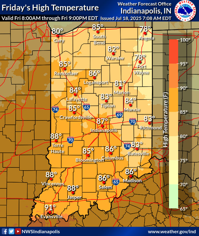
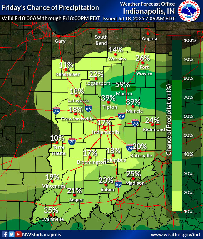
Today: Scattered early morning showers, especially north of Indy. Becoming partly cloudy. High 85.
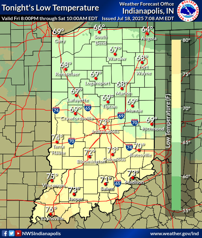
Tonight: Partly cloudy. Low 71.
Saturday: Partly to mostly cloudy, with showers and storms likely, mainly mid afternoon, when heavy rain and damaging wind gusts are possible. High 86.
Saturday Night: Showers and storms, mainly in the early evening. Heavy rain and damaging wind gusts possible. Low 72.
Sunday: Showers likely. Some thunder possible. High 85.
Sunday Night: Scattered showers and some thunder possible. Low 70.
Monday: Partly to mostly cloudy. Scattered showers and storms, especially in the morning. High 83.
Monday Night: Partly cloudy. Low 70.
Tuesday: Partly sunny. Spotty showers and storms. High 89.
Tuesday Night: Partly cloudy. Low 72.
Wednesday: Partly sunny. Very hot and humid. Spotty afternoon showers and storms.. High 92.
Wednesday Night: Partly cloudy. Low 75.
Thursday: Partly sunny. Very hot and humid. Spotty afternoon showers and storms.. High 93.


Never miss me! Subscribe for free. My Huge Radar has real-time weather tracking, current temperatures, and severe weather watches and warnings. Get detailed Indiana conditions by clicking here. Click here to see my central Indiana 7-Day Forecast. Follow these links to get my forecasts for Lafayette, Muncie, Hendricks County, and Hamilton County. Need a second opinion? Click here for central Indiana National Weather Service forecasts. (Some charts via WeatherBELL.)


